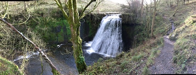
A walk of just under 4 miles to the lesser known but equally stunning Aysgill Force waterfall, with spectacular dales views along the way.

Table of Contents
The Route
- what3words for start point: ///deeper.townhouse.thorax
- Start / Finish Point: Hawes National Park Visitor Centre Car Park, Burtersett Rd, Hawes DL8 3NT
- Distance: 4 Miles
GPX Route Map
Download file for GPSWalk Description
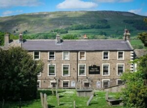
From the National Park car park just along the road from The House at Hawes head towards town. Pass the church and take the left turn, signed for Gayle Lane. The lane climbs between the church and cemetery before coming to a field. Cross the field on the paved path until you reach the road.
Turn left to the bridge in the middle of Gayle. On the near side of the bridge turn right at the footpath sign. Pass the houses and then turn left crossing a stone stile.
Climb the field beyond and continue to the signpost marked Aysgill Force. Head half left down towards Gayle Beck.
Cross a stile in a wall down to the beck on the left and head across the field to a gap in the wall. The path runs across the slope, above the beck, eventually joining a wall to the right. Follow this down to the beck just by a footbridge.
Turn left down the near side of the beck seeing the spectacular Aysgill Force. Below the gorge the path passes a small barn. Cross a stile beyond this and through a gap in the wall on the far side of a narrow field. Just beyond, look for a set of steps leading up from the beck. Cross a stile at the top, continue to the next stile to rejoin the original path.


