Welcome to Yorkshire
News • April 22nd, 2021
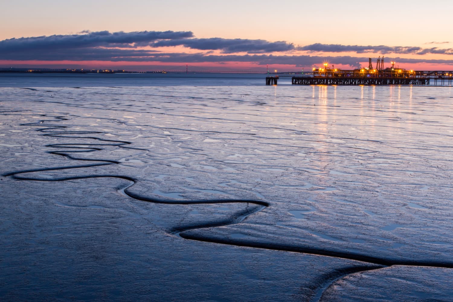
|An interesting trek around the landscape of one of Yorkshire’s most distinctive geographical areas. Some road walking required, but this route will certainly open your eyes into a different world and give great views across the estuary.

The Route
- what3words for start point: ///stews.filer.props
- Start / Finish Point: Car park at the end of Thorngumbald Rd, Paull, Hull, HU12 8AT
- Distance: 9 Miles
GPX Route Map
Walk Description
At the car park, with the River Humber in front of you, head to the coast path on the left, and walk alongside Fort Paull Museum. After the nest field, turn left, and follow the track away from the river, turning right at the track junction. Follow this, and then turn left just before the Gas Distribution Centre, keeping it on your right.
At Thorngumbald Road, turn left to cross over the drain, then immediately right on the public footpath alongside the drain. Eventually, the drain turns sharply right, and here, cross over the drain using the footbridge, then turn left to follow it - but on the opposite side.
When you reach a road - Dark Lane - turn left and walk along the road into the village of Thorngumbald. Turn left onto Church Lane at the crossroads and follow it all the way until it meets the A1033 Main Road.
Turn left and follow this out of the village - crossing over when you leave the village to walk on the pavement. When the pavement moves to the right, turn right to follow the B1240 Thorn Road.
Cross over five roads on the right, then crossover Thorn Road just at the flats. Turn left down Haven Basin Road, and follow this to the junction. Turn right, crossing over to the far side of the bridge for the pavement, then turn left down the footpath. Follow this path to eventually come out on an access road to the A1033.
Turn right and keep on this side of the road until you are opposite an access track on the other side of the road. Carefully cross and head down the track, bending to the right, then the left. Keep to the left and follow the track as it snakes around alongside Hedon Haven Clough drain. Cross Paull Road, and carry straight on to follow the drain.
Turn left at the natural boundary of the River Humber and walk on the coast path into Paull. Veer right onto Main Street and follow it through Paull. At the lighthouse, carry straight on, then over the steps along the concrete barrier to reach the car park.
Yorkshire Team
The Yorkshire.com editorial team is made up of local writers, content creators, and tourism specialists who are passionate about showcasing the very best of God’s Own Country. With deep roots in Yorkshire’s communities, culture, food scene, landscapes, and visitor economy, the team works closely with local businesses, venues, and organisations to bring readers the latest news, events, travel inspiration, and insider guides from across the region. From hidden gems to headline festivals, Yorkshire.com is dedicated to celebrating everything that makes Yorkshire such a special place to live, work, and visit.
View all articles →
Comments
0 Contributions
No comments yet. Be the first to start the conversation!