
Welcome to Yorkshire
News • February 19th, 2021
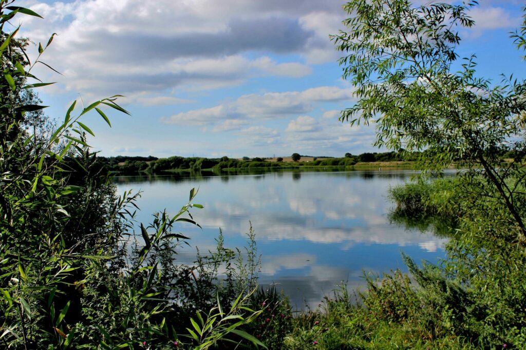
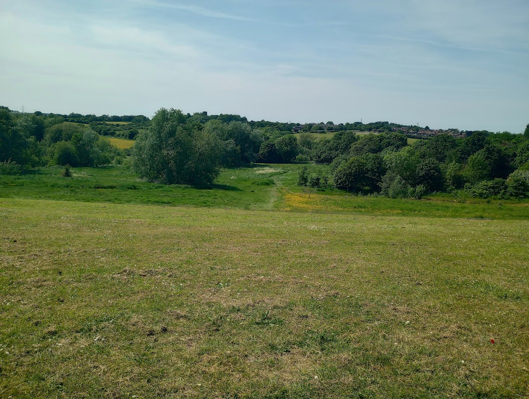
|A lovely easy walk through the fields between the villages of Havercroft and Kinsley, in-between Wakefield and Barnsley.
The Route
- what3words for start point: ///incur.flanked.lately
- Start Point: Bus stops on Cow Lane, near the corner of East Street, Havercroft, WF4 2HQ
- Finish Point: WF4 2HQ
- Distance: 5 Miles
GPX Route Map
Walk Description
From the bus stops on B6428 Cow Lane, walk towards and turn down East Street, and then left onto the access road to walk behind the houses. Follow this road around and turn left at the end onto a track called Tup Lane. Continue along the track, through the trees and around the business park, turning left at the corner to reach the entrance of the park. Carry on, with the business park on your left along Westoff Lane to meet houses at the edge of the village of South Hiendley.
At the corner with the farm lane on the left, turn right to follow Tun Lane. At the triangle junction with the main road, turn left and then left at the roundabout onto George Street. Just before the triangle School roadsign, turn left down the footpath snicket and follow this past the school. At the junction of paths, turn left and follow the path between the trees and across the field following the clear path on the ground. At the track, turn right, and then left at the first triangle junction, then right at the second triangle junction.
Follow this almost straight boundary between two fields, and eventually, you reach the outskirts of Kinsley. The path goes behind houses on the left, then turns left, crossing Tumbridge Crescent, to go behind houses on the other side of the road. At the end of the house, turn right, follow the field, then turn left Halfway along this field, a clear path on the right takes a diagonal across a field. Carry straight on, then left diagonally across another field, and then another. Turn right, walking at the back of some houses before reaching the B6428. Turn left to get back to the bus stop.
Yorkshire Team
The Yorkshire.com editorial team is made up of local writers, content creators, and tourism specialists who are passionate about showcasing the very best of God’s Own Country. With deep roots in Yorkshire’s communities, culture, food scene, landscapes, and visitor economy, the team works closely with local businesses, venues, and organisations to bring readers the latest news, events, travel inspiration, and insider guides from across the region. From hidden gems to headline festivals, Yorkshire.com is dedicated to celebrating everything that makes Yorkshire such a special place to live, work, and visit.
View all articles →
Comments
0 Contributions
No comments yet. Be the first to start the conversation!