Welcome to Yorkshire
News • September 21st, 2021
|A pleasant walk around the countryside of Pudsey.

The Route
- Start / Finish Point: On-road parking along Smalewell Road, Pudsey, LS28 8HU - Close to the Fox & Grapes pub.
- Distance: 5 Miles
GPX Route Map
Walk Description
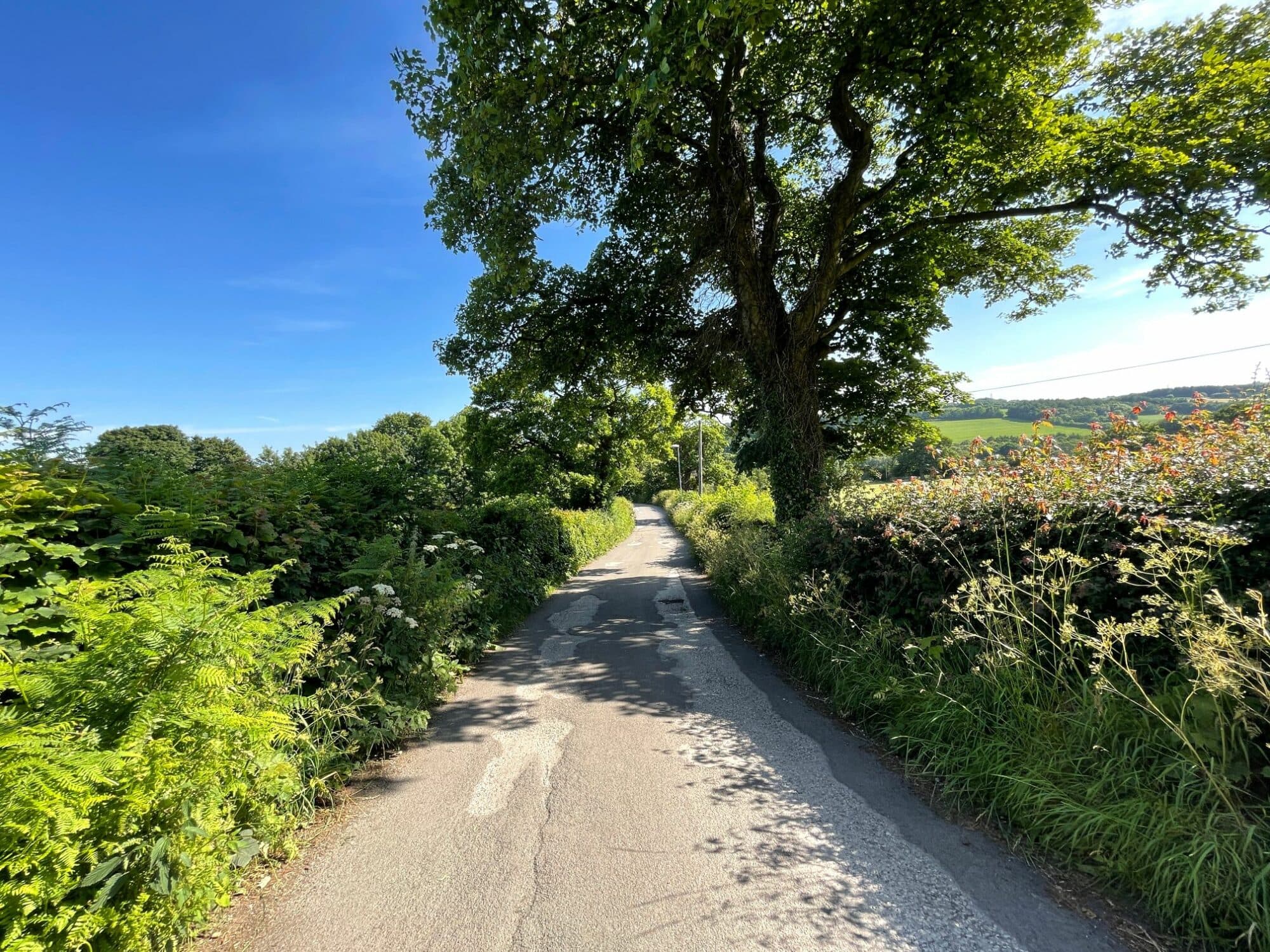
From where you’ve parked on Smalewell Road, walk down towards the Fox and Grapes pub. Just before you get to it, turn left down the Public Bridleway and follow it as it snakes around to the left. Keep on the clearer track to the left and follow it through the wood. When you reach a track running left to right, turn right, and then left into the field, just before Tyersal Beck. Follow this clear track across the field, and through the trees, until eventually you are walking along the beck.
Soon, you reach another track coming from the left, on the corner of Fulneck Golf Course. Carry on straight across into the trees and moving to the left away from the beck. Follow the edge of the trees, along the clear path on the ground until you reach a line of trees directly in front of you. Find the clearing in the trees, and enter to walk past a mill on the left and then out into open fields. Here, you follow the line of Pudsey Beck on the right for a while, following the path as it veers to the left around one cluster of trees, and then a little while later around another.
Follow the path as it comes out onto Roker Lane beside an electricity substation. Turn right here, cross over the road and turn left through the gap in the wall just past the bus stop. Veer to the right and follow the boundary along the line of the trees and following Pudsey Beck on your right. Eventually, the track turns left, but you carry on into the next field to the next boundary.
Turn left here just after the line of trees, and you can follow a clear path along the boundaries of several fields to reach Roker Lane again. Turn right, and follow Roker Lane until the sharp right bend when it becomes Southroyd Park. Turn left and walk down the road Fulneck until you reach a junction on the right. Here, carry on past the bins and down the gravel track straight ahead, not the road to the left for the Trekking Centre. At the gates at the end of the road, take the public footpath through the stile on the right and then turn right to follow the clear path across the field to the line of trees.
Follow the line of trees to reach the road Greentop. Cross over and carry on through the snicket to Smalewell Road. Turn left and follow the road until you reach where you parked.
Yorkshire Team
The Yorkshire.com editorial team is made up of local writers, content creators, and tourism specialists who are passionate about showcasing the very best of God’s Own Country. With deep roots in Yorkshire’s communities, culture, food scene, landscapes, and visitor economy, the team works closely with local businesses, venues, and organisations to bring readers the latest news, events, travel inspiration, and insider guides from across the region. From hidden gems to headline festivals, Yorkshire.com is dedicated to celebrating everything that makes Yorkshire such a special place to live, work, and visit.
View all articles →

Comments
0 Contributions
No comments yet. Be the first to start the conversation!