
Welcome to Yorkshire
News • September 1st, 2021
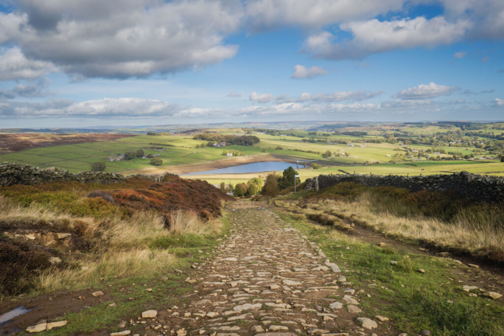
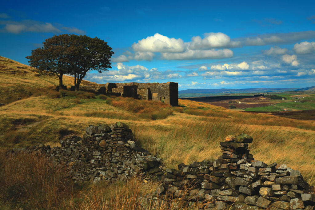
|A hearty moorland walk past Lower Laithe Reservoir and over Haworth Moor to the abandoned stone farmhouse of Top Withins.
The Route
- what3words for start point: ///flute.model.aunts
- Start / Finish Point: Lay by car park area Cemetery Road, Haworth, BD22 8EN
- Distance: 6.2 Miles
GPX Route Map
Walk Description
From the layby car park on Cemetery Road in Haworth, with the bench in front of you, turn right, and walk towards the cemetery. At the gate on the right, take the public footpath that runs initially parallel to the road, but then starts to move away to the right. Follow this path to go past a works on the right to reach Reservior Road.
Here, Lower Laithe Reservoir will be straight in front of you. Turn right and follow the road along the top of the embankment, and then up to Sun Lane. Turn left, and walk through the village of Stanbury - taking care as the pavements often disappear! Carry on past the village school and out of the village past the traffic calming islands.
At the road junction, veer left along Back Lane - ignoring the no through road sign - and continue along the lane. At the junction, keep to the left, and then at the end of the lane, head to the right, along the path marked “Private Road”. As this is a public footpath, you are allowed to walk on it. Follow this path, and then at the junctions, keep to the right, to walk past two farm buildings on the right.
This is now part of the Pennine Way. The path heads alongside some walled fields on the left, before clearly turning to the left to eventually find the remote abandoned stone farmhouse of Top Withins.
Once you’ve investigated, retrace your steps until you see a clear path branching out to the right. Take this path and when it joins another, turn left. Follow this to walk alongside South Dean Beck. Ignore the next two paths branching off, and stick to the main path - although the landscape is wild, stick to this clear path. After a while, three more paths branch off, and you should ignore those too.
Just after the edge of a walled field, at the junction of paths, head to the right, which is the easiest way to Bronte Bridge. Cross over the bridge, and look for the Bronte Waterfalls. Don’t turn down the path on the right, but continue on what is now part of the Bronte Way. Follow this very clear path, with green fields on the left and moorland on the right. Keep on this path until it reaches a crossroads. Here, head straight across, and down along Cemetery Road - keeping safe as it is a narrow road. Follow this all the way back to the laybe car park.
Yorkshire Team
The Yorkshire.com editorial team is made up of local writers, content creators, and tourism specialists who are passionate about showcasing the very best of God’s Own Country. With deep roots in Yorkshire’s communities, culture, food scene, landscapes, and visitor economy, the team works closely with local businesses, venues, and organisations to bring readers the latest news, events, travel inspiration, and insider guides from across the region. From hidden gems to headline festivals, Yorkshire.com is dedicated to celebrating everything that makes Yorkshire such a special place to live, work, and visit.
View all articles →


