Malton and Saint Mary's Priory is a 4.7 kilometer loop trail located near Malton, North Yorkshire, England that features a river and is good for all skill levels. The trail is primarily used for hiking and walking.
The Route
- what3words for start point: ///final.unicorns.wipes
- Start Point: Malton
- Finish Point: Malton
- Distance: 3 Miles
GPX Route Map
Walk Description
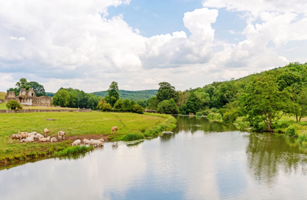
An easy access circular walk from the market town of Malton in Ryedale. The route explores the town's market place, a beautiful stretch of the River Derwent and a number of historic sites including Saint Mary's Priory, Orchard Fields (the site of an old Roman fort) and the site of the old castle.
The walk has a few gentle gradients. The majority of the route follows surfaced paths, but there is one stretch of grass path along the River Derwent that is uneven in part and can get muddy and soft in the wetter months. There are no stiles or kissing gates on route and the paths are all generous width. You will need to negotiate a handful of steps as well as a stretch of boardwalk. Taking all this into account it would be possible to take a rugged pushchair around the route during the dry summer months. Allow 2 hours.
There are public toilets in Malton Market Place near waypoint 1. If you are looking for refreshments you will be spoilt for choice with restaurants, pubs and cafes centred around Malton's Market Place at the start or end of your walk.
OS Map: Explorer 300 Howardian Hills and Malton.
This walk follows public footpaths and bridleways which cross private and public land.
On the Route
The New Globe Inn
mid point stay
The Old Lodge
mid point stay
Chapter Two Bar
mid point stay
St Michaels Tavern
on route pub
Pott 'in' Shed Cafe
on route food drink
Brass Castle Brewery
on route food drink
The Patisserie Malton
on route food drink
Malton Visitor Information Point
on route attraction
Chapter Two Accommodation
mid point stay
Maison Du Vin - Malton
on route food drink
Deli of Malton
on route food drink
