A riverside walk from the heart of Leeds Dock to Knostrop Lock.
The Route
- what3words for start point: ///hurray.social.museum
- Start Point: Leeds Dock
- Finish Point: Leeds Dock
- Distance: 4 Miles
GPX Route Map
Walk Description
Starting the walk from Leeds Dock, situated on the Aire & Calder Navigation, the walk is easy to navigate by following the riverside path to Knostrop Lock and Thwaites Mill. This route makes up part of the Trans Pennine Trail. As you leave the city centre from Leeds Dock look out for the street art that has been installed on the riverside.
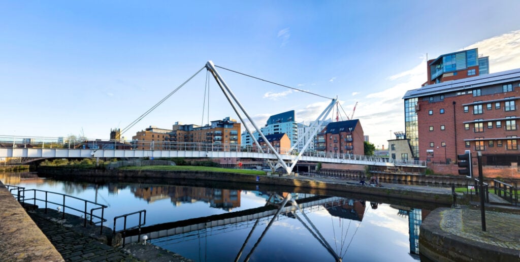
You will pass under the new rust coloured steel pedestrian bridge, which opened in 2019, linking the CITU development to the heart of the city. Moving further out you will walk around the edge of the Knostrop Quay housing development. After passing the estate you will need to cross the pedestrian bridge to follow the riverside path on the far side, where the route becomes more of a green corridor. Following the path, you will cross the river again on a footbridge bridge and arrive at Knostrop Lock.
Continue downstream, passing the small stone circle, until you reach Thwaite Watermill. Once you reach the mill you can follow the road round and pick the path back up at Knostrop Lock. You will need to cross the lock before retracing your steps back to Leeds Dock.
