
Welcome to Yorkshire
News • January 13th, 2021
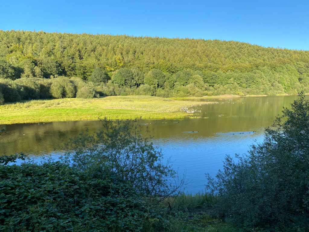
|Lindley Wood Reservoir is the oldest of the reservoirs in the Washburn Valley. Built between 1869 and 1876. Further up the valley are three others named Thruscross, Fewston and Swinsty.
Lindley Wood reservoir is situated further down the valley and a quiet, lesser known yet beautiful area to explore. There is no direct path covering the whole circumference of the water's edge but this 6 mile circular walk takes in not just the reservoir but the surrounding area too providing expansive views of the lower Washburn Valley as well as the reservoir from above.
This walk has so much all in one walk. Open countryside, a reservoir, forest paths, woodland paths and riverside paths and a bit of history. Perfect!
Parking
There is a small parking space for around 4 cars at the Dob Park Rd junction with Weston Moor Road. The Otley to Blubberhouses Road. (SE 195 492). If heading out of Otley, go up the hill on the Blubberhouses Road, past the turn off for Clifton. The road will bend right sharply then afterwards as it bends left sharply the junction is on your right. It is a dead end road and the spaces are immediately on the right as you enter the road.
Route
OS Map with GPX Route Marked:
Lindley Wood Reservoir
A lovely walk for a pleasant afternoon, around the countryside surrounding the Lindley Wood Reservoir - built in 1869.
From the parking spot, turn right, then immediately left down the public footpath. Follow this clear track through the wood to the edge of Lindley Wood Reservoir. After a small clearing, the track enters the wood again, so follow it through, crossing a bridge over Church Gill, eventually coming out onto the B6451 to the left of Lindley Lodge. Turn left, crossing over the viaduct - with stunning views over the reservoir on the left and Norwood Bottom on the right. Take care as there is no pavement here and vehicles can be travelling fast. The road turns right, then left, and then there’s a public footpath along a track to Crag Farm on the right. Follow this long, straight track, but just before it turns right to the farm, take the footpath on the left to walk alongside a boundary. As you enter the next field, head for the far left corner, cutting across the field, then follow the boundary on your right all the way around to eventually meet the B6451 again. Climb the wall stile and carefully cross over the road, taking the footpath on the right, set into a farm access track. Follow the hedgerow on the right across two fields until you reach a quiet road through a gate. Turn left, and follow this road all the way until it turns left over Lindley Bridge to where you parked.
Andrew White
Start Location: Small parking area off Cinder Lane, near Lindley Bridge, Otley LS21 2LA
Walk finish location: As start
Walk down Dob Park Road for 100m and take the right turn where the signpost says The 6 Dales Trail.
Follow the track and keep to the right hand track when there is a divergence. This will give you outstanding views down toward the reservoir as well as a unique view of Almscliffe Crag in the near distance.
The track then leads you down into Crag Farm. Pass through and past the farm and as soon as the track bears left you take the gate the first gate on the right.
Pass through this field keeping the wall to your right and in the next field, turn left, and you will see a high ladder stile to go over.
As you walk through these fields you get a real good views down to the reservoir below but also over the whole lower Washburn Valley. Forest covered hills and green fields in every direction.
Head down the slope. Keep to the right hand side of the field as it bends round to the right.
At the end of the field in the corner you will see a stile with home made handrails that leads onto the road. Go straight across the road taking care and onto the footpath directly across.
Walk through the next two fields and through the gate onto the lane where you will turn left and walk down it until you cross the bridge.
Immediately after crossing the bridge you will see and take a path that heads left off the lane and into the woods. Signposted Norwood Bottom.
This is the reservoir path proper and you follow it all the way along. Lindley Wood itself is enchanting at any time of year.
A very quiet footpath that provides a great forest walk combined with views across the reservoir.
Follow this track all the way to the end where you will meet the road again and turn left across the bridge.
Immediately after the bridge turn right over a stile and onto a path by the River Washburn.
You will eventually come to a bridge that takes you across onto the right hand side of the river and carry on. Keeping the river to your left.
You will eventually come to a ford with a pretty setting by the river and an old moss covered 17 century packhorse bridge. A perfect place for a picnic by the water.
Cross that bridge and follow the track that goes uphill and turns into a tarmac lane. This leads you all the way up and back to your starting point. This will be the steepest part of the trail so take your time and enjoy turning around and looking back across the valley.
Nearby Places to Stay and Eat
The nearest town is Otley in West Yorkshire (3 miles away) which in itself is a lovely place to take in if visiting the area. There are many shops, cafes and restaurants to choose from as well as a great bustling market on certain days. There are a few bed and breakfasts to choose from too.
Attractions near Lindley Wood
The other way north for around 5 miles is Mackenzies Smokehouse Farm Shop at Blubberhouses. A huge place selling not just farm and food products but many housewares and unique items. The cafe is fantastic and can highly recommend their roast Sunday dinner.
Yorkshire Team
The Yorkshire.com editorial team is made up of local writers, content creators, and tourism specialists who are passionate about showcasing the very best of God’s Own Country. With deep roots in Yorkshire’s communities, culture, food scene, landscapes, and visitor economy, the team works closely with local businesses, venues, and organisations to bring readers the latest news, events, travel inspiration, and insider guides from across the region. From hidden gems to headline festivals, Yorkshire.com is dedicated to celebrating everything that makes Yorkshire such a special place to live, work, and visit.
View all articles →


