
Discover Camblesforth
Camblesforth is a village located in North Yorkshire, governed by North Yorkshire Council (formerly Selby). With a population of approximately 1,600, it falls within the YO8 postcode area. The village is notable for its proximity to the historically significant Selby Abbey, offering insights into the region's rich heritage.
Explore the map below to discover accommodation, attractions, restaurants, and live events across Camblesforth. Scroll down to browse featured listings and plan your perfect visit.
Stay in Camblesforth
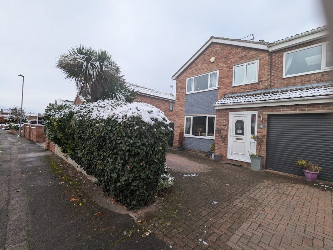
Pawsome Pad
Located in the charming area of Carlton, Pawsome Pad offers convenient parking for visitors. While primarily a pet care facility, it provides easy access to local attractions in Goole. Ideal for tourists traveling with pets, ensuring a worry-free stay.
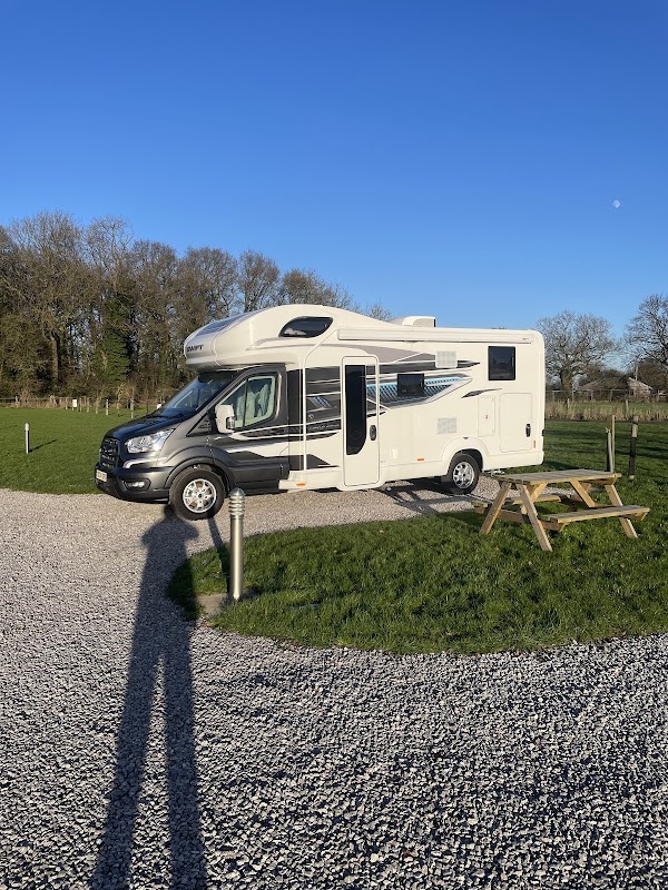
Laurels Park Campsite
Laurels Park Campsite in Drax, North Yorkshire offers a serene camping experience with large grass and hard standing pitches. Ideal for campervans, the site is dog-friendly and features essential amenities like toilets and a shower. Enjoy picturesque views over the fields in a peaceful setting.
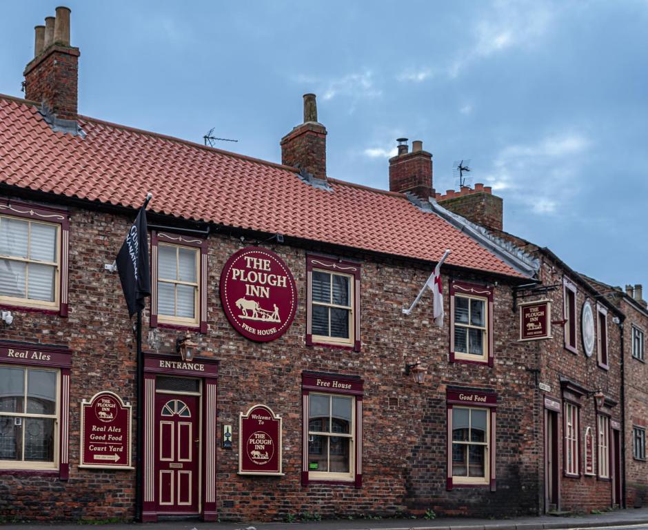
Apple Blossom Caravan and Camping
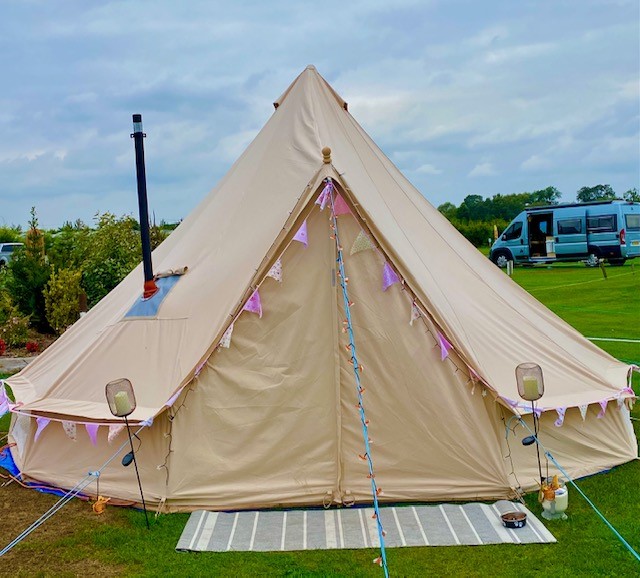
Apple Blossom Caravan and Camping in Hirst Courtney offers spacious pitches perfect for large tents, with excellent facilities including clean toilet and shower blocks. Located in a peaceful setting, it provides a relaxing retreat with the convenience of a nearby pub and friendly staff.
Things to Do in Camblesforth
Carlton Towers Estate
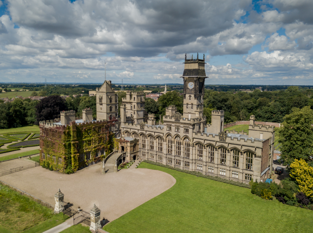
Carlton Towers Estate offers convenient parking options for visitors exploring this historic venue in Carlton, Goole. Located on High Street, the parking facilities are ideal for those attending weddings, events, or simply enjoying a day out at this magnificent estate. With easy access and modern payment options, your visit is sure to be hassle-free.
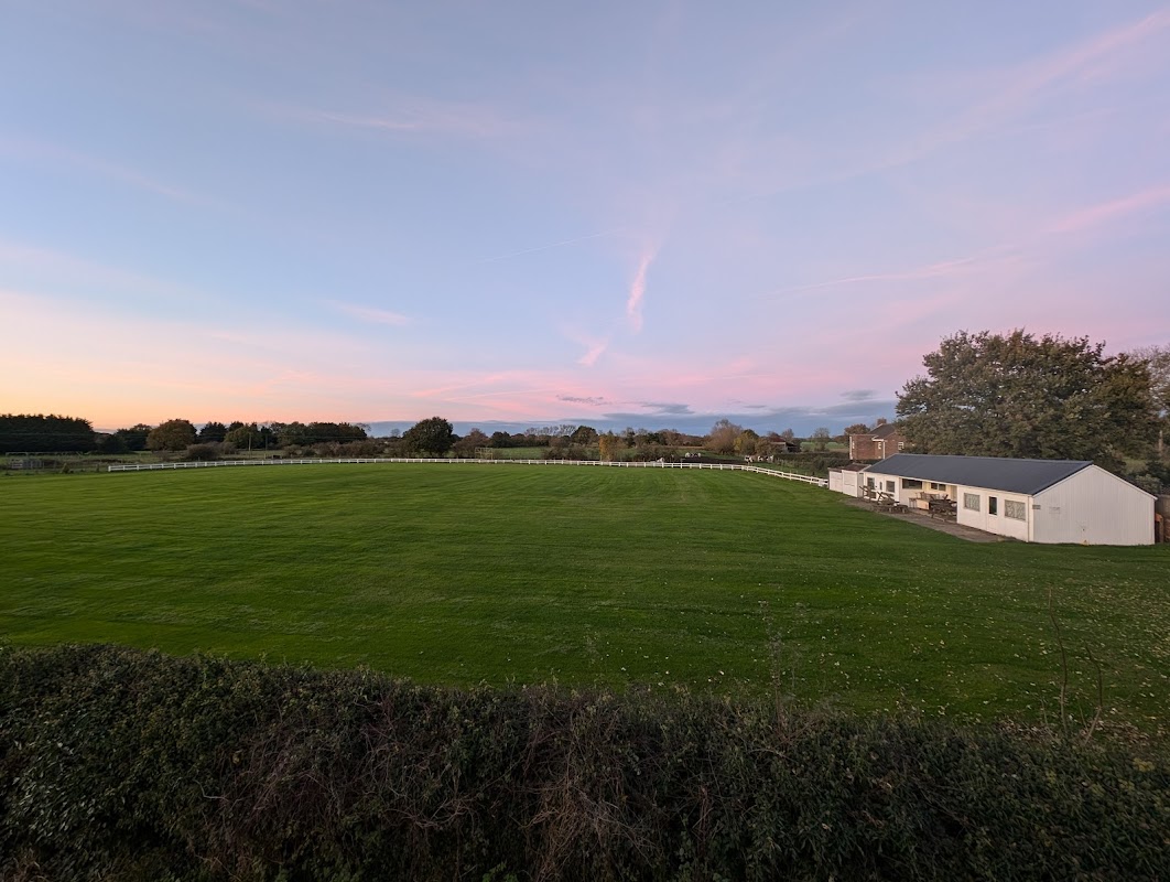
Hirst Courtney Cricket Club
Hirst Courtney Cricket Club offers convenient parking for visitors looking to enjoy a day of cricket in the charming village of Hirst Courtney. Located on Back Lane, this facility is perfect for sports enthusiasts and those exploring the Selby area. While payment options are not specified, it is advisable to prepare for standard pay-and-display arrangements.
Browse by Type
Food & Drink
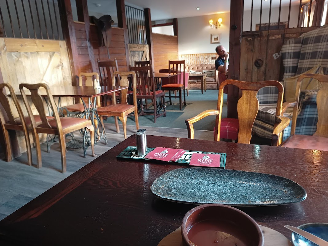
Comus inn
Located in Camblesforth, near Selby, the Comus Inn offers convenient parking options for visitors looking to enjoy a delightful dining experience. While the parking specifics are not detailed, the facility likely operates on a pay-and-display basis, typical for the area. Visitors can enjoy the charming surroundings and delicious Turkish cuisine with ease of access.

Flamino Pizzeria & Grill
Located in the charming village of Camblesforth, Flamino Pizzeria & Grill offers a delightful dining experience with its renowned kebabs and pizzas. While enjoying the local cuisine, visitors can find standard pay-and-display parking options nearby, making it convenient for tourists exploring the Selby area.
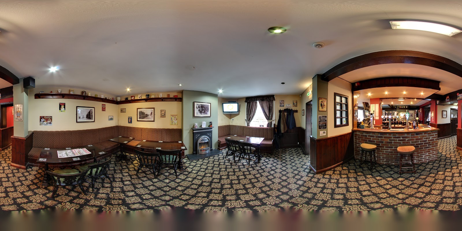
Black Lion
Located in the charming village of East Cowick, the Black Lion offers a welcoming atmosphere with its classic pub setting. Visitors can enjoy a variety of drinks, including local ales, in a friendly environment. While the pub itself doesn't explicitly mention parking facilities, the surrounding area typically offers pay-and-display options for convenience.
Browse by Type

Interactive Map
View accommodation, attractions, restaurants, and events on the map
Geographic Facts
This village is geographically within the following regions:
- Population
- 1,568
- Postcode
- YO8
- Administrative area
- North Yorkshire Council (formerly Selby)
Data sourced from Wikidata and verified public records


Latest news from Camblesforth
All Local News →
From Local Farm to National Shelves: How a North Yorkshire Rapeseed Oil Business Wins Listing with Garden Centre Chain
A North Yorkshire farm business, Charlie & Ivy's, has landed a major nationwide listing! Find their award-winning rapeseed oil bread dippers in Dobbies now.
Walkshire in Camblesforth
More Walks in Camblesforth →
Walk: Barmby on the Marsh
A lovely trek alongside the Ouse and the Derwent rivers, with a little bit of countryside and villages to explore along the way. Drax and the River Ouse The Route what3words for start point: ///late.waltzes.calculating Start Point: Barmby Tidal Barrage Car Park, High Street, Barmby on the Marsh, DN14 7HX Finish Point: DN14 7HX Distance: 8 Miles GPX Route Map walkshirebarmbyonthemarshDownload Walk Description With the car park behind you, turn right and go through the bollards and turn left after the fence on the left to double back on yourself, so the car park is on your left side. Follow the Trans Pennine Trail for a long while alongside the River Ouse. When you get near the wind farm on the opposite bank, look out for a public footpath on the left. Follow this path all the way until it turns into Landing Lane. Turn left down Back Lane, then right down South Lane, and then left down Main Street. Carry on down Main Street and turn right down the bridleway of Marsh Lane, just before the National Speed Limit signs on Main Street. The track turns to the left, then, after the first field on the right, turn right and continue to the far end of the field. Then turn left, follow the drain Old Derwent, on the right. Go through the gap in the hedgerow and follow the line of the boundary on the right as it snakes to the right and then slightly to the left. Cross over the lane and find the stile, which is slightly to your left ahead, then turn left and follow the River Derwent all the way back to the swing bridge, where you turn left and then left again to get back to the car park where you parked.

Walk: Carlton West and the River Aire
This is a pleasant easy circular walk with stunning views of the river. There are also great views of Snaith, Carlton Towers Lake and the remains of an ancient bridge. The Route what3words for start point: ///pairings.appoints.public Start / Finish Point: Snaith Station, DN14 9HY Distance: 3.4 Miles GPX Route Map carltonwestandtheriveraireDownload Walk Description Leave the Station Car Park through the pedestrian Gate and turn right. Follow the pavement on to the bridge. Stop on the bridge to watch the river and to observe the remains of the toll bridge built in 1777. Its constriction enabled a turnpike road to be created between Bawtry and Selby. Carry on walking, past the lake. During the first half of the 20th century(until 1961) the frozen lake was the venue for the Yorkshire ice skating championships. Notice the ice skates depicted on the CARLTON sign as you carry on walking to the mouth of Carlton Towers main entrance Cross the road. EXTREME CAUTION. BUSY ROAD. Walk along Low Street until you reach Hirst Road. There is a footpath on the bank on the left hand side. Walk on the footpath until you are opposite Hanger Lane. Cross the road WITH CARE and walk up Hanger Lane. Continue up Hanger Lane until you reach a track on the left. Turn left on the track and keep on it until you reach Hirst Road. Turn left and walk along the right hand side of Hirst Road. No pavement TAKE CARE. You are now on a section of The Trans- Pennine Trail. After the bungalow, turn right towards the farm.13.Go through the pedestrian gate on the left on to the flood bank. Walk along the flood bank with great views of the bridge and Snaith Church. At the end of the flood bank, go through the pedestrian gate and up the hill on to the pavement. Turn right and walk across the bridge, observing the tidal river in the opposite direction. When it is safe to do so, cross the road on to the opposite pavement and return to Snaith Station.

Walk: A riverside stroll at Carlton
A very pleasant stroll through the countryside on this circular walk with a section devoted to The River Aire as it meanders between Carlton and Snaith. The Route what3words for start point: ///sharpened.bounding.observe Start / Finish Point: Carlton Village Hall, Church Ln, Carlton, Goole DN14 9PB Distance: 4.3 Miles GPX Route Map riverviewDownload Walk Description On this walk, that starts from Carlton Village Hall, you will see the river, Carlton Bridge, excellent views across the river to Snaith from the flood bank as well as pleasant countryside tracks. Turn left down Low Street and walk to the cross-roads. Cross the road and turn right on the footpath that runs along the bank on the left-hand side of Hirst Road. Follow the footpath as it forks to the left. Go through the gate on the left and follow the lane. At the end of the lane, the path goes to the right and then the left and reaches a gate. Go through the gate, climb on to the flood bank, turn left and walk towards the bridge. At the end of the flood bank, there is a gate. DO NOT GO THROUGH THE GATE. Turn right and go over the stile and then turn right on the riverbank footpath. Continue on the riverbank footpath until you reach a stile. Go over the stile and then turn right up a track. At the top of the track, turn right on another track. Look out for a footpath on the left and then join that footpath that leads to a gate. Go through the gate and turn left on the flood bank. Walk along the flood bank to the end and through another gate. Turn right to Hirst road and then turn left. Keep to the right-hand side. There is no pavement. TAKE CARE on this stretch. Look for a track on the right, after the last house, and turn up the track. At the end of the track, turn right into Hanger Lane. At the end of Hanger Lane, WITH CARE, cross the road to re- join the bank top footpath you walked along earlier, but this time turn left. At the end of the footpath, turn left, cross the road and follow Low Street back to the Village Hall.

Walk: Pollington Canal, Cowick Gorse and Dorr Lane
This circular walk through the countryside to Pollington uses part of The Trans Pennine Trail. There are splendid views of the canal and an optional diversion to Pollington Lock. The nearest shops and food outlets are in Snaith. The Route what3words for start point: ///pairings.appoints.public Start Point: Snaith Station Car Park DN14 9HY SE643223 Finish Point: Snaith Station Car Park Distance: 7.75 Miles GPX Route Map pollingtoncanalcowickgorseanddorrlanewalkDownload Walk Description A mixture of road, field side, track and canal side walking under a wide-open sky are the features of this Heritage Walk. (HW no7) There are 15 Heritage Walks in this area and walk packs are available locally. Details are given on the Walkers Information Board at the station. Leave the car park through the vehicle entrance and turn left on George Street. Look out for a community path on the right. Walk up the path, passing a Blue Plaque that highlights the old primary school. At the end of the path, there is a HERITAGE BOARD giving the history of the Methodist Church that you have passed. Turn left, cross the road at the bollards and then turn left. Turn right up Mill Lane and follow the lane round a left-hand bend. Look out for a way marker to a very narrow footpath. Go down the footpath, turn right at the end and then left down Finnley’s Lane. Go over the motorway bridge and just before the bottom of the hill, turn right on a footpath.10 Follow the way-markers around the wood, over a dyke, through a camp and out onto a road. Turn right on a track and round a left-hand bend. Ignore a right fork and walk straight forward, eventually alongside Cowick Gorse. At the end of this section, turn right, eventually reaching the canal bank. Follow the canal bank and then a tarmac lane which leads to a bridge over the canal. Good views along the canal to Pollington Lock. An optional diversion from here along the left bank to the lock and a HERITAGE BOARD will add a total of one mile to your journey. From the bridge, bear left up the lane which will lead to Long Lane. Walk alongside Long Lane, over the motorway to the main road. Cross the main road, turn right and then left down Dorr Lane. This is an ancient green lane and was the burial route from Pollington to the graveyard at Snaith Church. At the top of a slight rise, turn right onto a footpath. Keep on this footpath all the way to Church Lane. Turn right and left passing the church. Turn left down Buttermarket and then right on Mill Street and back to the station.