
Discover Kilnwick Percy
Kilnwick Percy is a village located in the East Riding of Yorkshire. Governed by East Riding of Yorkshire Council, the village is part of a region known for its rural landscapes and agricultural heritage. Visitors can explore the nearby Yorkshire Wolds and enjoy the village's serene environment.
Explore the map below to discover accommodation, attractions, restaurants, and live events across Kilnwick Percy. Scroll down to browse featured listings and plan your perfect visit.
Property in Kilnwick Percy
Explore property in Kilnwick Percy — homes and commercial listings for sale and to rent. Start with detached houses.
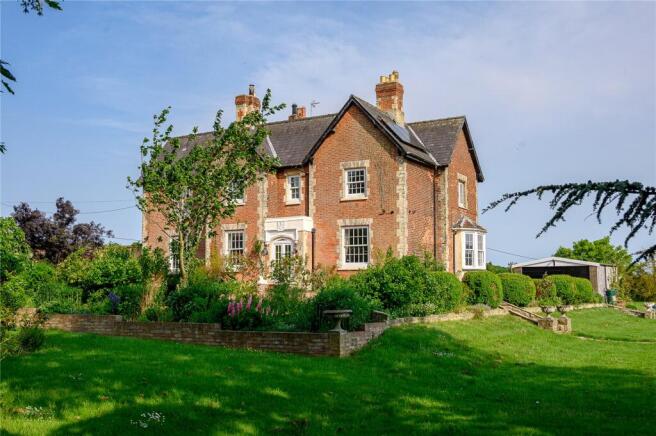
6 Bed Detached House - Featherbed Lane, Kilnwick-percy
£1,200,000
Browse by type
Stay in Kilnwick Percy

Clayfield Farm Wedding & Events
Clayfield Farm Wedding & Events in Kilnwick Percy offers convenient parking for guests attending weddings and events at this stunning venue. Located near Pocklington, York, the facility provides easy access to the beautiful countryside setting, ensuring a memorable experience for all visitors.
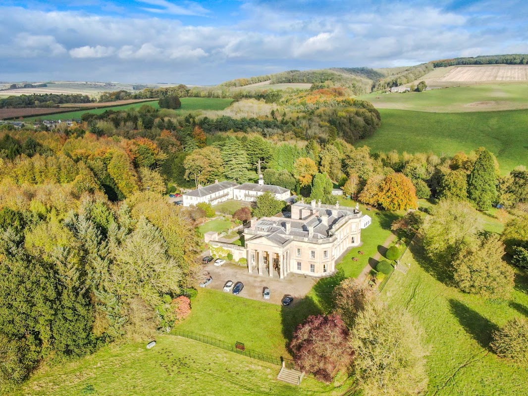
Madhyamaka Kadampa Meditation Centre
Located in the serene countryside of Kilnwick Percy, the Madhyamaka Kadampa Meditation Centre offers a peaceful retreat with its beautiful gardens and historic buildings. Visitors can enjoy meditation classes, a cozy cafe, and a gift shop, making it a perfect spot for relaxation and spiritual exploration. Parking is available on-site, ensuring easy access to this tranquil destination.
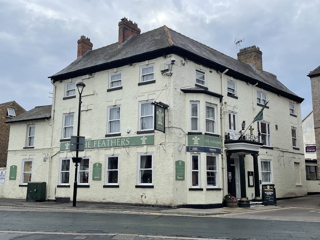
The Feathers Hotel
The Feathers Hotel in Kilnwick Percy offers convenient parking for guests and visitors in the charming town of Pocklington. While enjoying your stay, explore the local area with ease, knowing that parking is available just steps from the hotel's bright rooms and relaxed restaurant.
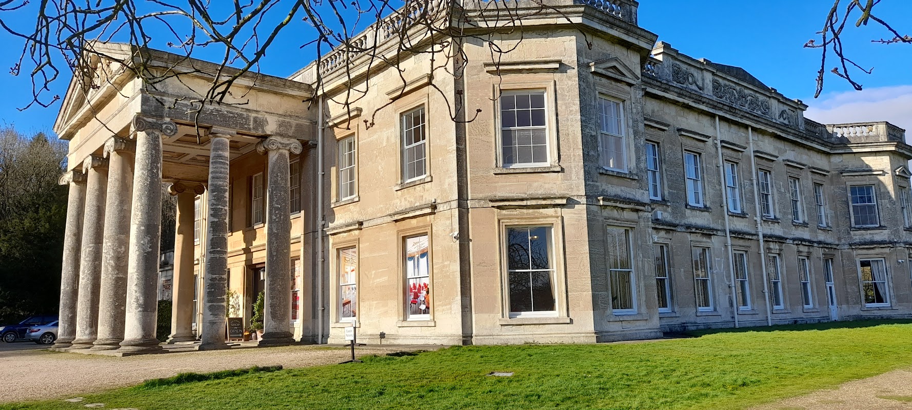
The Wolds Retreat
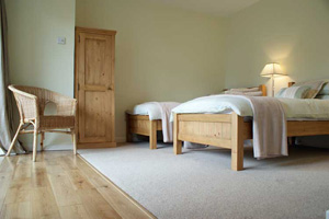
The Wolds Retreat in Kilnwick Percy offers a serene parking experience for visitors to this peaceful Buddhist retreat. Located in the picturesque countryside near Pocklington, York, it provides easy access to the tranquil surroundings ideal for meditation and relaxation. While parking payment details are unknown, visitors can enjoy the calm atmosphere and friendly community.
The Wolds Retreat B & B
Kilnwick Percy Resort & Golf Club
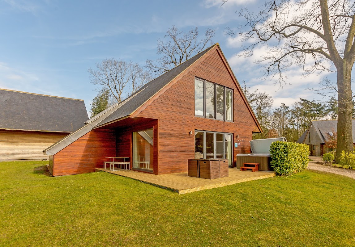
Located in the scenic village of Kilnwick Percy, the Kilnwick Percy Resort & Golf Club offers convenient parking for guests and visitors. This upmarket resort features stylish accommodations, a luxurious spa, and two exquisite restaurants, making it an ideal destination for relaxation and leisure. Whether you're here for a round of golf or a rejuvenating spa day, you'll find ample parking facilities to enhance your visit.
Browse by Type
Things to Do in Kilnwick Percy
Clayfield Farm Wedding & Events
Clayfield Farm Wedding & Events in Kilnwick Percy offers convenient parking for guests attending weddings and events at this stunning venue. Located near Pocklington, York, the facility provides easy access to the beautiful countryside setting, ensuring a memorable experience for all visitors.
The Box Health & Fitness Studio

The Glasshouse Restaurant
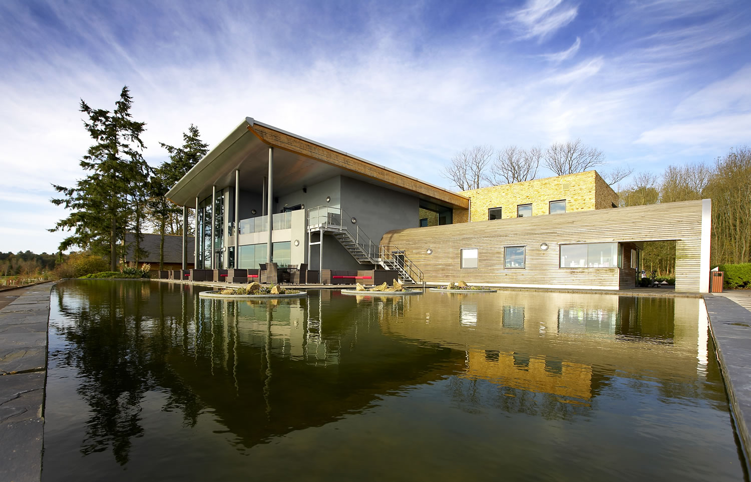
The Glasshouse Restaurant at Kilnwick Percy offers a delightful dining experience with modern and spacious interiors, complemented by stunning views over the golf course and the surrounding wolds. Located within a resort setting, it provides a perfect spot for tourists to enjoy a meal after exploring the beautiful grounds. The restaurant is known for its excellent food and attentive service, making it a must-visit for visitors in the Pocklington area.
Food & Drink

WHISK
Located in the charming area of Kilnwick Percy, WHISK offers a delightful stop for tourists exploring Pocklington and York. This cafe provides a vibrant atmosphere with a diverse menu, perfect for a relaxing break during your travels. Note that parking is likely pay-and-display, so be prepared for standard parking fees.
World Peace Cafe Pocklington
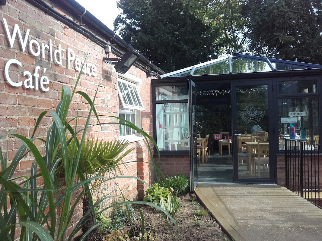
Located at Kilnwick Percy Hall in the serene surroundings of Pocklington, the World Peace Cafe offers a tranquil retreat for visitors. While enjoying a delightful selection of cakes and beverages, tourists can appreciate the calm atmosphere adjacent to a meditation centre. The parking facility is likely a standard pay-and-display, ensuring convenient access to this peaceful destination.
The Mile Cafe
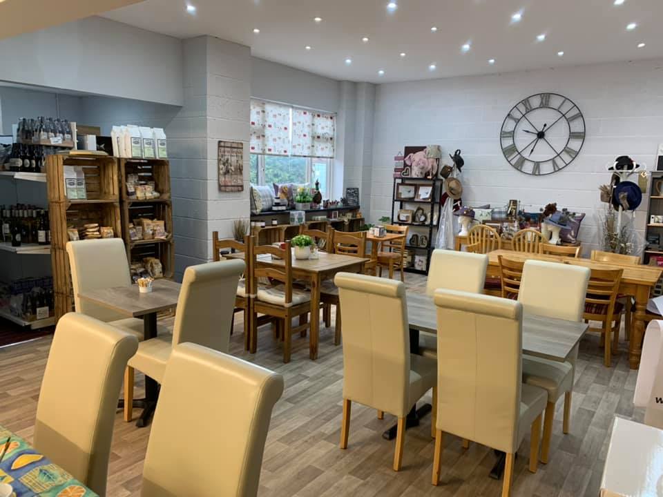
Located in the charming area of Kilnwick Percy, The Mile Cafe offers a delightful stop for travelers exploring Pocklington and the surrounding Yorkshire countryside. While enjoying a delicious meal at the cafe, visitors can conveniently park their vehicles in the nearby pay-and-display parking area, ensuring a hassle-free experience. The cafe is known for its friendly staff and dog-friendly atmosphere, making it a perfect spot for both food lovers and pet owners.

Interactive Map
View accommodation, attractions, restaurants, and events on the map
Geographic Facts
This village is geographically within the following regions:
- Administrative area
- Nunburnholme
- Dialing code
- 01759
Data sourced from Wikidata and verified public records
Upcoming Events in Kilnwick Percy
View All Events in Kilnwick Percy →No events found for Kilnwick Percy yet.
No events found for this period. Check back soon!
View all events in Kilnwick PercyLatest news from Kilnwick Percy
All Local News →
Natural England Proposes New Area of Outstanding Natural Beauty in Yorkshire Wolds
Natural England has proposed a new Area of Outstanding Natural Beauty in the Yorkshire Wolds, aiming for formal recognition to conserve its stunning landscapes for future generations.

Goole & Howdenshire Business Excellence Awards – Winners: The Complete List of 2026 Honorees
The Goole & Howdenshire Business Excellence Awards 2026 was a huge celebration. See the full list of winners from the record-breaking ceremony in Yorkshire.
Walkshire in Kilnwick Percy
More Walks in Kilnwick Percy →
Walk: Pocklington Canal
A beautiful example of a rural canal. An easy stroll by the water to imagine a slower pace of life in Victorian Yorkshire whilst marvelling at the stunning waterside views. Make sure you take a camera!! The Route what3words for start point: ///contents.direction.quoted Start Point: Pocklington Finish Point: East Cottingwith Distance: 9 Miles GPX Route Map pocklington-canalDownload Walk Description Follow the Pocklington canal on this flat 9 mile route to East Cottingwith. You'll get a real sense of how the canal was used in Victorian times as there are many repurposed building to spot as well as the beautiful boats using the space today. As with most canals there is an abundance of wildlife to see on the route. Watch out for the elusive kingfisher darting around the water as well as swans, ducks and geese. Ideal for the family if you're helping the younger members of the family with that school history project.

Walk: Yorkshire Wolds Way National Trail
One of the flagship walking routes in Yorkshire, the Yorkshire Wolds Way runs for 79 miles across the beautiful and peaceful Yorkshire Wolds between Hessle, near the Humber Bridge and Filey on the North Yorkshire coast. The Route what3words for start point: ///manliness.looked.complains Start Point: Hessle Finish Point: Filey Brigg Distance: 79 Miles GPX Route Map yorkshire-wolds-way-1Download Walk Description The Yorkshire Wolds Way is one of England’s National Trails. Deservedly so for the outstanding landscape and beautiful countryside along the full length of its 79 miles between Hessle near the Humber Bridge and Filey on the North Yorkshire Coast. Renowned for its peace and tranquillity, the walk hits top marks for anyone looking to maximise their wellbeing. People love the stunning dry grass valleys that the path bends and curves its way along in harmony with nature. Poetry benches are dotted along the route – a place to relax and contemplate life, the universe and everything! There is a warm welcome and often a pub in villages along the way, with a chance for a friendly chat with the locals over a decent pint of Yorkshire ale.

Walk: The Chalkland Way
The Chalkland Way is a scenic circular walk that takes you through the picturesque landscapes of the Yorkshire Wolds. Stretching approximately 40 miles, this route offers walkers a chance to explore the region's rolling chalk hills, peaceful valleys, and charming villages. Whether you're seeking a leisurely stroll or a more challenging adventure, the Chalkland Way promises a rewarding journey through one of England's most tranquil and unspoiled areas. The Route what3words for start point: ///tolerable.innovator.moss Start Point: Pocklington Finish Point: Pocklington Distance: 40 Miles GPX Route Map chalklandwayDownload Walk Description The Chalkland Way is a picturesque circular walking route that spans approximately 40 miles through the serene landscapes of the Yorkshire Wolds. This delightful route was devised by the East Yorkshire Area of the Ramblers Association and provides walkers with a varied experience. Starting from the historic market town of Pocklington, the Chalkland Way begins its journey through the charming countryside, initially heading towards the village of Millington. This section of the walk introduces you to the classic chalk landscapes that characterize the Wolds, with gently rolling hills, open fields, and sweeping views of the surrounding areas. Millington is a quaint village, perfect for a short rest, and is known for its friendly pub, which is a great spot to enjoy some local hospitality. From Millington, the route continues through the lush valleys and secluded dales that define this area, with particularly beautiful stretches around the Millington Dale and the dry valleys of Warrendale and Nettle Dale. The path then leads you past the village of Huggate, one of the highest points in the Yorkshire Wolds, offering panoramic views that are well worth the climb. From near Huggate, the route meanders through more rolling hills and farmland, passing through the villages of Wetwang, Fimber and Burdale. These small settlements offer glimpses into rural life in the Wolds and are perfect spots to take a break and appreciate the tranquillity of the area. From here, the route heads towards the village of Thixendale, a hidden gem nestled in a deep valley. Thixendale is a particularly scenic part of the walk, surrounded by steep hills and offering a peaceful retreat in the heart of the Wolds. The final stretch of the Chalkland Way leads you back towards Pocklington, passing through the gentle slopes and open fields that make this area so distinctive. Overall, the Chalkland Way is a route that can be enjoyed by walkers of all levels, providing a perfect escape into the tranquil landscapes of the Yorkshire Wolds.

Walk: The Wilberforce Way
The Wilberforce Way is a scenic long-distance walking route in East Yorkshire, named in honour of William Wilberforce, the famous abolitionist who campaigned tirelessly to end the transatlantic slave trade. This trail stretches for approximately 60 miles, winding through picturesque countryside, charming villages, and significant historical sites, offering walkers a journey through both natural beauty and rich heritage. The Route what3words for start point: Start Point: Hull Finish Point: Pocklington Distance: 60 miles Book "Wilberforce Way" by John Eckersley - click here (#ad) GPX Route Map Wilberforce-WayDownload Walk Description The Wilberforce Way begins in the historic city of Hull, where William Wilberforce was born. The starting point is at the Wilberforce House Museum, which provides an insightful introduction to Wilberforce's life and work. From here, the route heads northwest, leaving the urban environment behind and entering the peaceful East Yorkshire countryside. Hull to Beverley Beverley Minster Distance: About 10 miles Highlights: As you leave Hull, the path follows a network of footpaths and bridleways, taking you through farmland and small villages. This section concludes in the historic market town of Beverley, renowned for its beautiful Minster, cobbled streets, and traditional architecture. Beverley to Pocklington Distance: Approximately 20 miles Highlights: Leaving Beverley, the route meanders through the rolling hills of the Yorkshire Wolds. Walkers will pass through idyllic villages such as Cherry Burton and Bishop Burton, each offering picturesque views and a chance to experience local rural life. The path eventually reaches Pocklington, a charming town with a rich history and a vibrant community. Pocklington to Market Weighton Distance: Around 10 miles Highlights: This section of the Wilberforce Way takes you along peaceful country lanes and footpaths, with the dramatic backdrop of the Yorkshire Wolds' chalk hills. Market Weighton, known for its Giant Bradley heritage, is a delightful market town perfect for a rest stop. Market Weighton to Londesborough and Goodmanham Distance: Approximately 10 miles Highlights: From Market Weighton, the route continues through the scenic village of Londesborough, with its historic estate and parkland. Walkers then pass through Goodmanham, a village steeped in history, before reaching the final stretch of the journey. Goodmanham to Pocklington Canal Distance: About 10 miles Highlights: The final leg of the Wilberforce Way leads walkers along the peaceful Pocklington Canal, offering serene waterside views and abundant wildlife. The canal path provides a gentle interlude to the journey. Pocklington to York The route begins by following the Pocklington Canal until it intersects with the B1228 road. From there, it continues through Sutton-Upon-Derwent. The trail crosses the River Derwent just outside Elvington, skirting the village and joining the Jorvic Way towards Wheldrake. Exiting Wheldrake to the north, the route crosses the A64 and enters the Heslington suburb of York near the University of York. Continuing west, the path traverses Walmgate Stray and crosses the A19 (Fulford Road) to reach the east bank of the River Ouse. The final leg follows the river, concluding at Lendal Bridge before turning towards its terminus at York Minster. Practical Information Total Distance: Approximately 60 miles (97 kilometers) Difficulty: Moderate, with some gentle inclines and varied terrain Terrain: A mix of urban paths, rural footpaths, bridleways, and canal towpaths Access: The route is accessible year-round, with spring and summer offering the most favorable walking conditions. Tips for Walkers Footwear: Sturdy walking boots are recommended, especially in wetter conditions. Supplies: Carry sufficient water, snacks, and a packed lunch, as amenities can be sparse in some rural sections. Navigation: While the route is signposted, a detailed map or GPS device is advisable for ensuring you stay on track. Accommodation: There are numerous options for overnight stays along the route, including bed and breakfasts, inns, and campsites. The Wilberforce Way offers a unique blend of historical significance and natural beauty, making it a rewarding experience for both avid walkers and those interested in England's rich cultural heritage. Walking this route not only honours the legacy of William Wilberforce but also allows you to immerse yourself in the stunning landscapes of East Yorkshire.