
Discover Sinnington
Sinnington is a village located in North Yorkshire, within the YO62 postcode area. Governed by North Yorkshire Council, it is home to a population of 318 residents. The village is notable for its proximity to the North York Moors National Park, offering visitors access to scenic landscapes and outdoor activities.
Explore the map below to discover accommodation, attractions, restaurants, and live events across Sinnington. Scroll down to browse featured listings and plan your perfect visit.
Stay in Sinnington
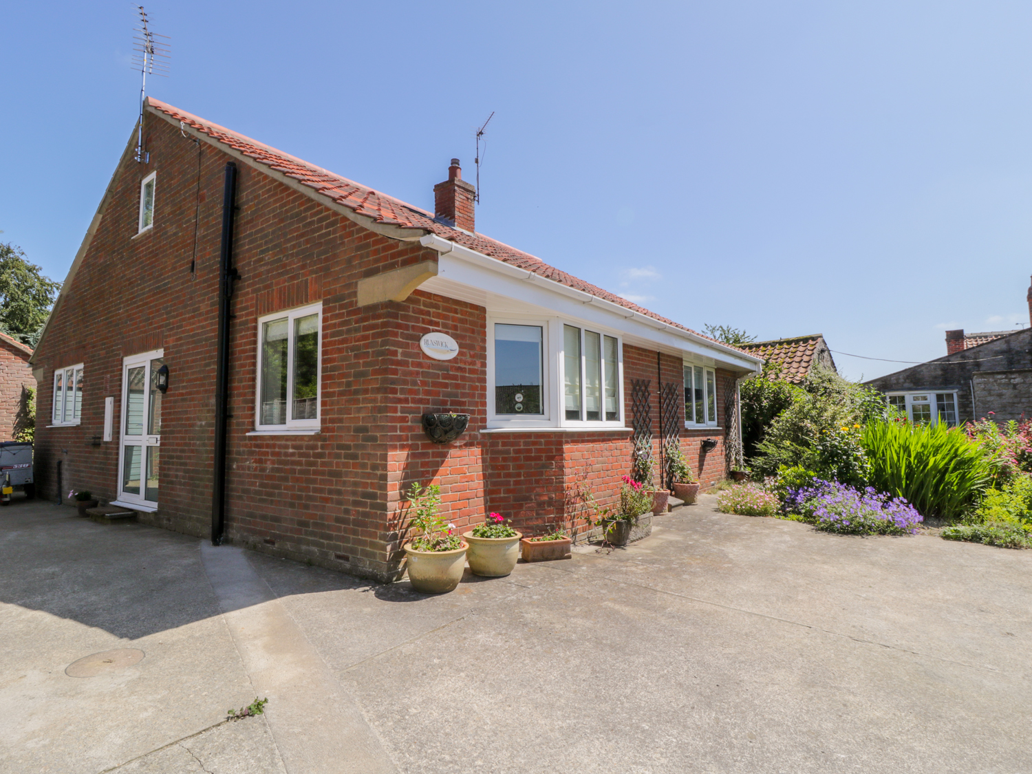
Runswick
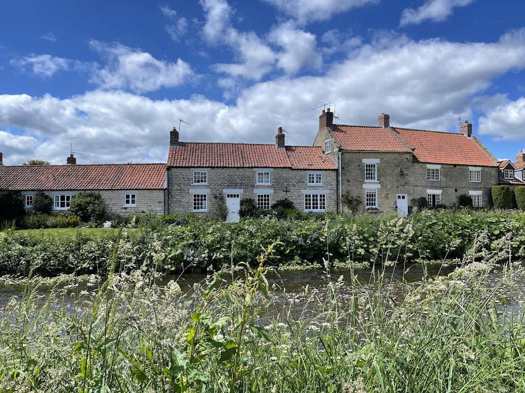
The Fox & Hounds Country Inn
The Fox & Hounds Country Inn in Sinnington offers a charming parking experience in a picturesque village setting. While specific parking details are not provided, visitors can enjoy the convenience of nearby parking options as they explore this delightful 18th-century inn with its renowned restaurant and cozy pub atmosphere.
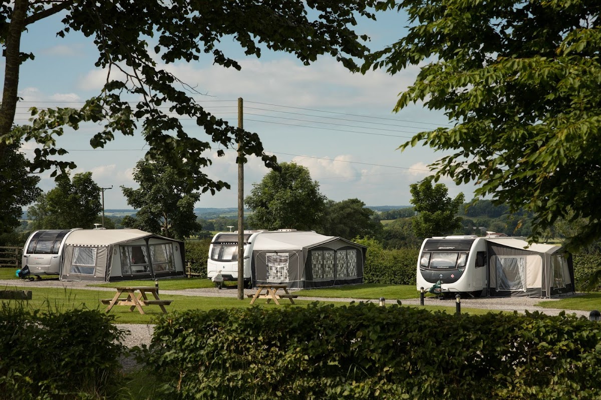
Cliff Farm Holidays - Caravan Park Pickering, North Yorkshire
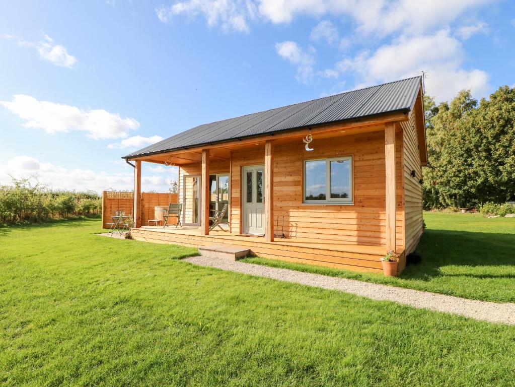
Cliff Farm Holidays offers a serene caravan park experience in the picturesque village of Sinnington, North Yorkshire. Guests can enjoy free parking alongside amenities such as free Wi-Fi, kitchenettes, and scenic farm views with animals like cows and sheep. This peaceful retreat is perfect for those looking to escape the hustle and bustle of city life.
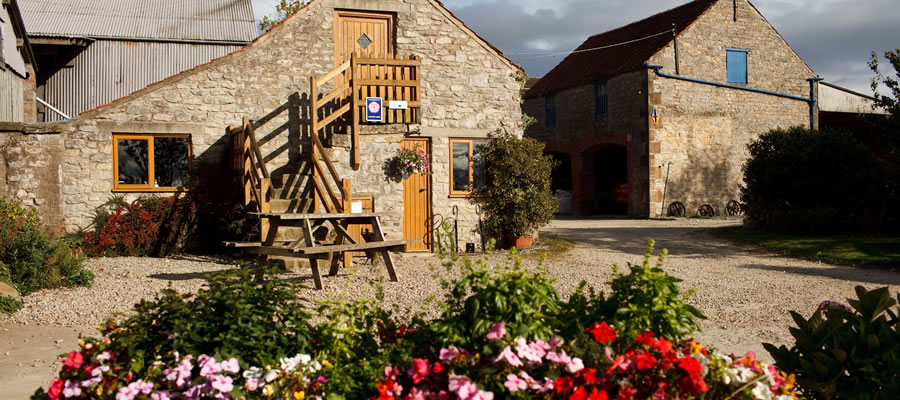
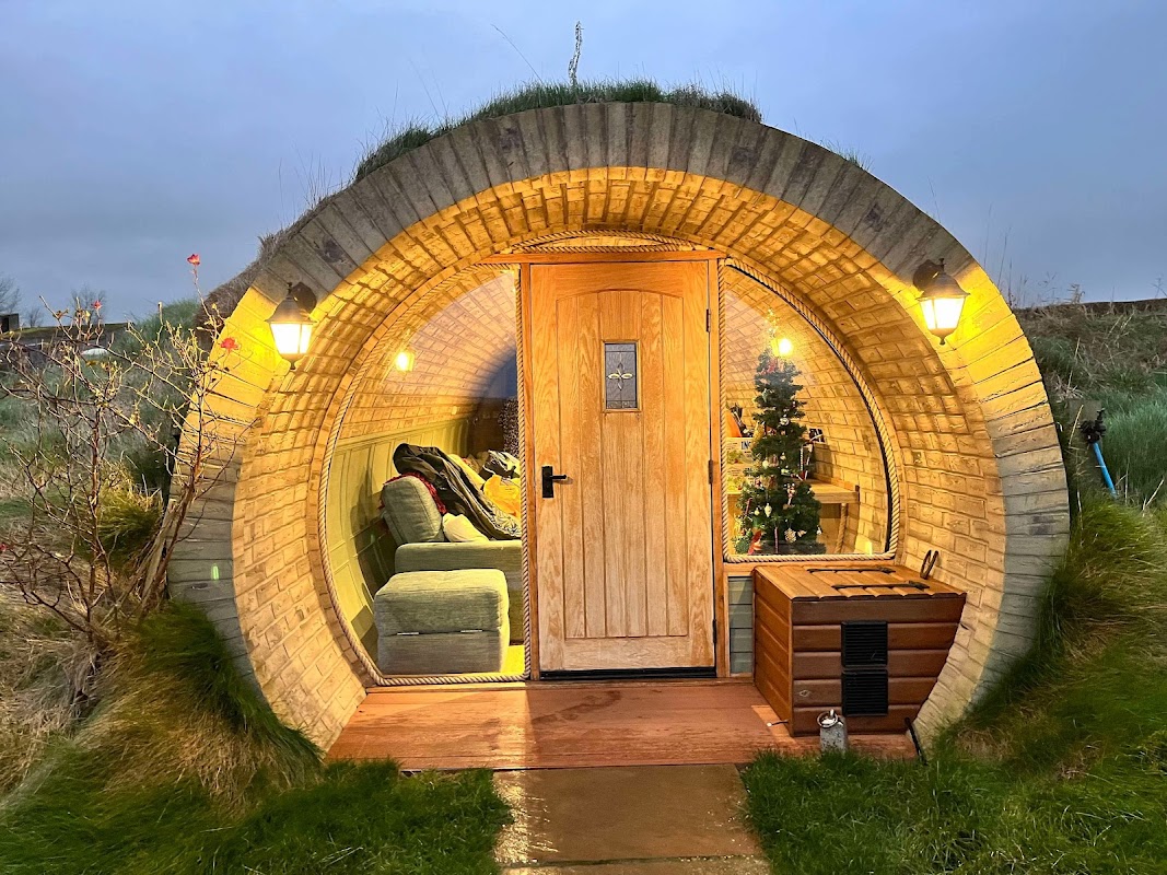
Yorkshire Burrows
Yorkshire Burrows offers a serene parking experience at Cliff Farm in Sinnington, York. Nestled in the picturesque countryside, this facility provides easy access to local attractions and amenities, making it an ideal spot for tourists seeking a peaceful retreat. Enjoy the stunning views and the convenience of nearby lodging options.
Browse by Type
Things to Do in Sinnington
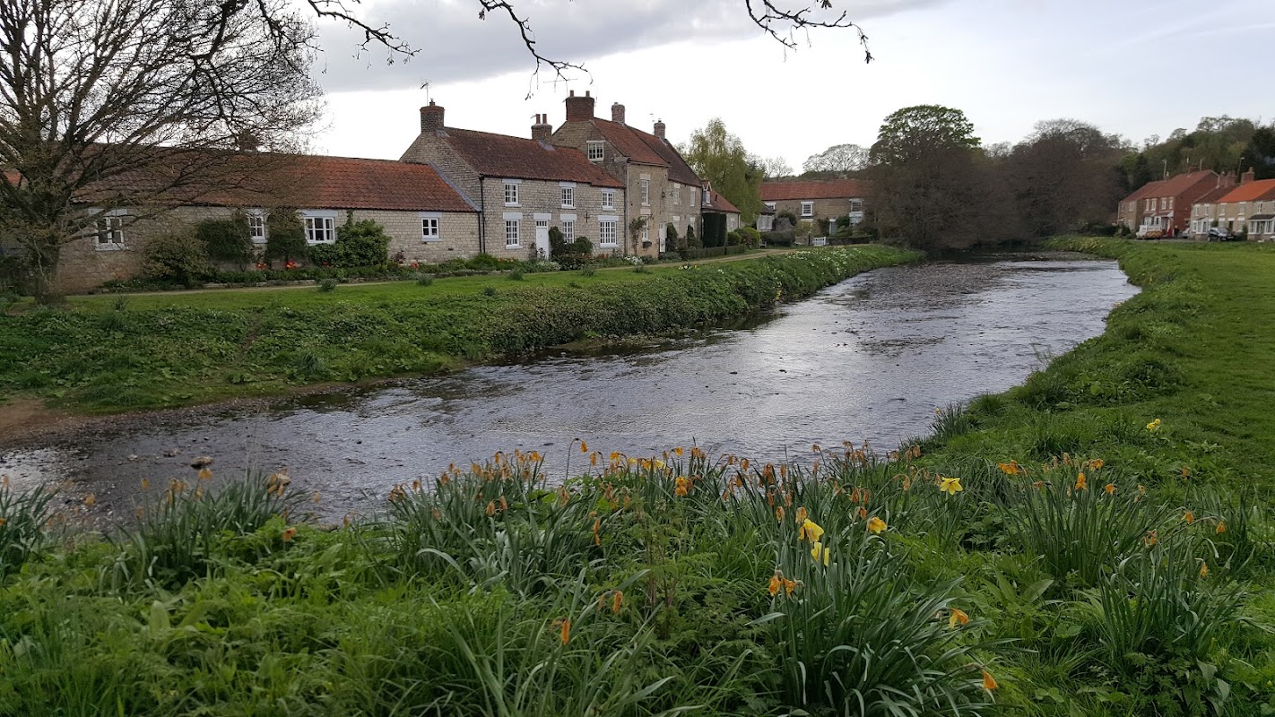
Sinnington Common
Sinnington Common offers convenient parking for visitors exploring the picturesque village of Sinnington. Located on Main Street, this facility provides easy access to the charming medieval church and the scenic village green, perfect for a peaceful picnic or a leisurely stroll. Enjoy the tranquil surroundings and the nearby attractions with ease.
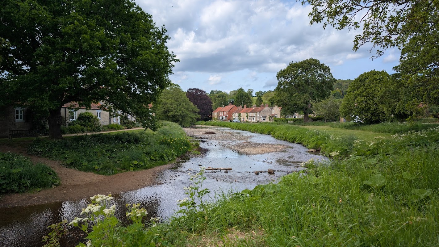
Sinnington Village Hall
Sinnington Village Hall offers a convenient parking option for visitors exploring the charming village of Sinnington. The car park operates on a voluntary donation basis, making it a flexible choice for tourists. Located near local attractions, it provides easy access to the village's amenities and scenic walks.
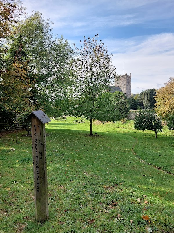
Kirkbymoorside Peace Pole
Discover the Kirkbymoorside Peace Pole, a serene monument crafted from a Yorkshire gatepost, inscribed with a message of global peace.
Food & Drink
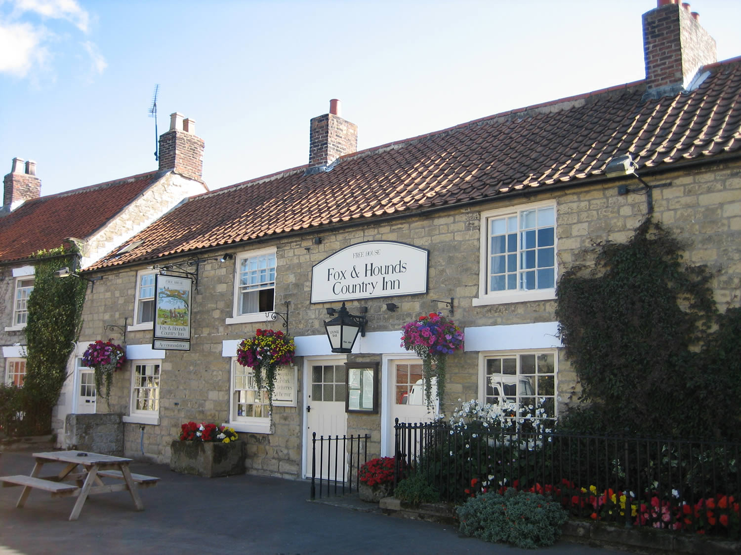
The Fox & Hounds Country Inn
The Fox & Hounds Country Inn in Sinnington offers a charming parking experience in a picturesque village setting. While specific parking details are not provided, visitors can enjoy the convenience of nearby parking options as they explore this delightful 18th-century inn with its renowned restaurant and cozy pub atmosphere.


Interactive Map
View accommodation, attractions, restaurants, and events on the map
Geographic Facts
- Population
- 318
- Postcode
- YO62
- Administrative area
- North Yorkshire
Data sourced from Wikidata and verified public records
Upcoming Events in Sinnington
View All Events in Sinnington →
Browse by Type
Latest news from Sinnington
All Local News →
From Local Farm to National Shelves: How a North Yorkshire Rapeseed Oil Business Wins Listing with Garden Centre Chain
A North Yorkshire farm business, Charlie & Ivy's, has landed a major nationwide listing! Find their award-winning rapeseed oil bread dippers in Dobbies now.

Pickering Farm Shop to Host Race Night for Macmillan Cancer Support
Join Cedarbarn in Pickering for a charity race night on May 1st! Enjoy a steak pie supper & support Sabrina Coultas's Macmillan fundraising horse race. Get tickets now!
Walkshire in Sinnington
More Walks in Sinnington →
Walk: Kirkbymoorside and Gillamoor
Kirkbymoorside and Gillamoor is a 9.3 kilometer loop trail located near Kirkbymoorside, North Yorkshire, England that offers scenic views and is rated as moderate. The trail is primarily used for hiking, walking, and trail running. The Route what3words for start point: ///skills.paces.centrally Start / Finish Point: Market Pl, Kirkbymoorside, York YO62 6AA Distance: 6 Miles GPX Route Map kirkbymoorsideandgillamoorDownload Walk Description A circular walk from the market town of Kirkbymoorside in Ryedale. The route heads north through Manor Vale Woodland and open fields to reach nearby Gillamoor with its pretty church and surprise view, before returning through plantations alongside the River Dove. The walk has several climbs and descents throughout, including one steep climb within the plantation on the return leg. Many of the bridleways through woodland can be very muddy, slippery and rutted at times so good boots are a must. You will need to negotiate several wide field gates plus one stile (this is in the second half of the walk and has a tight wooden fence surround, so dogs may need a lift over). You will cross one horse paddock and you may also come across livestock in a couple of pastures in the second half so take particular care with dogs. Allow 3 hours. There are public toilets in Town Farm car park (just behind the library) at the start and end of the walk. If you are looking for refreshments, you will find The Royal Oak pub in Gillamoor about half-way round (just before waypoint 3) or there are plenty of pubs and cafes centred around the Market Place in Kirkbymoorside at the start and end of the walk. OS Map: Explorer OL26 North York Moors Western Area. This walk follows public footpaths and bridleways which cross private and public land. Please respect people's privacy, keep dogs under control and remember the Countryside Code.

Walk: Kirkbymoorside and Ravenswick
Kirkbymoorside and Ravenswick is a 6.1 kilometer loop trail located near Kirkbymoorside, North Yorkshire, England that features a great forest setting and is rated as moderate. The trail is primarily used for hiking, walking, and running. The Route what3words for start point: ///cucumber.clef.moving Start / Finish Point: Piercy End, Kirkbymoorside, York YO62 6DG Distance: 4 Miles GPX Route Map kirkbymoorsideandravenswickDownload Walk Description A circular walk from the market town of Kirkbymoorside in Ryedale. The route heads east and north, visiting the site of the former Ravenswick Hall, the beautiful Ravenswyke Woods and a long stretch of Manor Vale Woods. The walk has several climbs and descents throughout, including a couple of quite steep sections. A few sections (especially in the woodlands) can be very muddy so good boots are a must. You will need to negotiate one field gate and several kissing gates, but there are no stiles or livestock on route. Allow 2 hours. There are public toilets in Town Farm car park (just behind the library) at the start and end of the walk. If you are looking for refreshments there are plenty of pubs and cafes centred around the Market Place in Kirkbymoorside at the start and end of the walk. OS Map: Explorer OL26 North York Moors Western Area. This walk follows public footpaths and bridleways which cross private and public land. Please respect people's privacy, keep dogs under control and remember the Countryside Code.

Walk: Kirkbymoorside and St Gregory's Minster
Kirkbymoorside and St Gregory's Minster is a 7.2 kilometer loop trail located near Kirkbymoorside, North Yorkshire, England that features a river and is rated as moderate. The trail is primarily used for hiking, walking, and running. The Route what3words for start point: ///skills.paces.centrally Start Point: Kirkbymoorside Finish Point: Kirkbymoorside Distance: 4 Miles GPX Route Map kirkbymoorsideandstgregorysminsterDownload Walk Description A circular walk from the market town of Kirkbymoorside in Ryedale. The route heads west through open fields and pastures, visiting Kirkdale Cave (where a fascinating set of fossilised bones were discovered) and St Gregory's Minster along the way. The walk has many gentle gradients throughout plus a couple of short steep slopes. A few sections (including the paths close to the cave and minster) can be very muddy so good boots are a must. You will need to negotiate several kissing gates, some stepping stones (although these can be avoided if you wish) plus 13 stiles (the majority of these stiles are tall and have tight wooden or wire fence surrounds so dogs will need a lift over). You will cross one horse paddock, several sheep pastures and a couple of fields that may be holding cattle so take particular care if you do choose to take a dog with you. The route crosses the main A170 road (which can be very busy) twice, so ensure you take time to wait for a suitable gap in the traffic. Allow 2.5 hours. There are public toilets in Town Farm car park (just behind the library) at the start and end of the walk. If you are looking for refreshments there are plenty of pubs and cafes centred around the Market Place in Kirkbymoorside at the start and end of the walk. OS Map: Explorer OL26 North York Moors Western Area. This walk follows public footpaths and bridleways which cross private and public land. Please respect people's privacy, keep dogs under control and remember the Countryside Code. Stay in Kirkbymoorside There's a wide range of accommodation to choose from nearby:

Ryedale Market Towns Trail: Part 6 Kirkbymoorside to Helmsley
Ryedale Market Towns Trail: Part 6 Kirkbymoorside to Helmsley is a 14.3 kilometer point-to-point trail located near Kirkbymoorside, North Yorkshire, England that offers scenic views and is rated as moderate. The trail is primarily used for hiking, walking, nature trips, and bird watching. The Route what3words for start point: ///dividers.taped.pothole Start Point: Kirkbymoorside Finish Point: Helmsley Distance: 9 Miles GPX Route Map ryedalemarkettownstrailpart6kirkbymoorsidetohelmsleyDownload A linear walk from Kirkbymoorside to Helmsley in North Yorkshire, forming the sixth and final part of the Ryedale Market Towns Trail. The route heads west through a mixture of open crop fields, sheep pastures and woodland valleys with gorgeous views from the hilltops. Along the way there are several interesting landmarks including Kirkdale Cave (where a fascinating set of fossilised bones were discovered), St Gregory's Minster, the predominantly thatched village of Pockley and the magical woodland ravine of Riccal Dale. ABOUT The Ryedale Market Towns trail is a 67 mile (108km) long-distance circular trail, created to allow walkers to enjoy the highlights of Ryedale, visiting each of the five market towns along the way. It is published through a collaboration with the Ryedale District Council. For more visitor information on the area including events and accommodation, go to www.VisitRyedale.co.uk ACCESS The walk has several steady climbs and descents throughout, plus a couple of steeper sections through Riccal Dale. The paths are mostly unmade and can get very muddy after periods of rain and in winter. You will need to negotiate several gates and kissing gates, two footbridges (one of which has steps each end) plus 5 stiles (a couple of which have tight fence surrounds so dogs will need a lift over). You will be sharing many of the pastures with sheep, so take particular care with dogs. There are only a few short sections along country lanes. Allow 4.5 hours. LOGISTICS If you are completing the whole 67 mile trail, you can arrange accommodation at both ends of this stretch, in Kirkbymoorside and in Helmsley. If you are walking this stretch as a stand-alone 9-mile walk, you can catch a bus for the return leg. Bus 128 will take you from Helmsley Market Place to Kirkbymoorside Market Place, taking just 20 minutes. The buses usually run hourly Mon-Sat and every two hours on Sundays. FACILITIES There are public toilets at each end of the walk. If you are looking for refreshments, there are lots of shops (including two bakeries) in Kirkbymoorside if you want to buy picnic supplies and you will be spoilt for choice in Helmsley at the end of the walk. OS Maps: OL26 North York Moors Western Area. This walk follows public footpaths and bridleways which cross private and public land. Please respect people's privacy, keep dogs under control and remember the Countryside Code. Access a list of all the segments that make up this walk here.