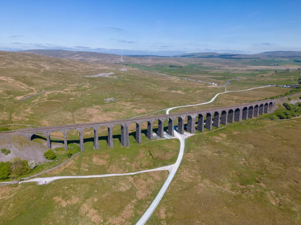
The Ribblehead viaduct is one of the most dramatic Victorian engineering achievements of the era. This short walk gives a real feel and understanding of the feat.
The Route
- what3words for start point: ///rent.imagined.intestine
- Start Point: Parking places on the road at Ribblehead
- Finish Point: Ribblehead
- Distance: 5 Miles
GPX Route Map
Walk Description
There is plenty of car parking on the road at Ribblehead. Walk towards the viaduct but do not pass under it. Continue alongside the railway for half a mile to a tunnel under the railway on your left. There is an option here to continue for a further half mile to stand above the railway and look in to the extraordinary mile and a half Blea Moor Tunnel . Return to the tunnel under the railway to Winterscales. Past the farm take the track on your left and return to pass under the viaduct. It is only then that you can understand the extraordinary scale of the structure.
