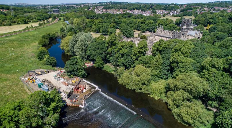
This walk takes you between two fish passes. Before summer 2020 fish hoping to reach the gravel beds in shallower parts of the upland river to lay their eggs were stopped by the weirs at Kirkstall Abbey and Armley Mills.
The Route
- Start Point: Kirkstall Abbey
- Finish Point: Kirkstall Abbey
- Distance: 2.1 miles
GPX Route Map
Walk Description
what3words for start point: ///advice.silver.beans
This walk takes you between two fish passes. Before summer 2020 fish hoping to reach the gravel beds in shallower parts of the upland river to lay their eggs were stopped by the weirs at Kirkstall Abbey and Armley Mills. Many fish need to move within the river to feed, breed and shelter. One of the fish that will have travelled the furthest is the Atlantic salmon.
Salmon will have travelled from the Atlantic Ocean around Greenland to lay their eggs in the shallow upland streams they are born in. These fish pass help connect 60km of river habitat. Their construction will allow salmon to return after an absence of over 150 years.
Food & Facilities
The Kirkstall Bridge Inn serves food & there is a café at Kirkstall Abbey.
