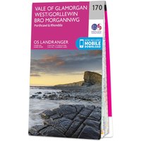
Ordnance Survey OS Map of Vale of Glamorgan West: Landranger 170
by Ordnance Survey
Compare 3 Retailers
Save up to £5.19 by comparingAmazon
Check live price on Amazon.co.uk
eBay
Check availability and price on eBay.co.uk. Yorkshire.com may be paid for purchases made through this link, by eBay Partner Network.
Can’t find it elsewhere?
Product Description
More products from Millets
Browse their full range on Yorkshire.com
Popular in Textile Art Gauges & Rulers
Browse all Textile Art Gauges & Rulers
Seam Measuring Gauge (Somometer), 1 piece
£9.90

T-shaped Marking Ruler 500mm - Precision 90 Degree Line Planning Tool Woodworking Measurement Gauge
£50.99

5/7/9 Inches Sewing Acrylic Wallet Ruler Template DIY Handcraft Ruler Wallets Making Tool Gift For Enthusiasts Hand Craft
£7.54

2Pcs Slotted Quilting Ruler Set Acrylic Patchwork Templates for Accurate Sewing Marking Square and Rulers Quilting
£8.11

Fabric Weight Tester Intelligent Electronic Scale with Circular Cutter Textile GSM Measuring Tool
£1646.41

Township Tour in Cape Town South Africa
£37.00
What You're Buying
What Yorkshire.com visitors have been buying recently

Hugo Boss Flawless Women's Multifunction Watch - 36mm Rose Gold Dial with Silver Mesh Bracelet
£179.00

Ortigia - Fico d'India Body Cream 300 ml - Moisturizing Body Cream
£61.00

ASUS ROG Strix OLED XG27ACDMS 27-Inch Gaming Monitor
£544.99

Oman Luxury - Wasla Eau de Parfum 100 ml - Unisex Woody Perfume
£220.00

Hyundai 56cc Petrol Brushcutter and Grass Trimmer, 2-in-1, Includes Harness
£119.99

Continental VanContact Ultra ( 215/65 R16C 109/107T 8PR Dual Branding 106T, EVc )
£135.31