Browse
Books
4,365 productsUpdated June 2026
Sort:

Ordnance Survey
Ordnance Survey Aldershot 1896-1904 - Historical Reproduction Map - 1 Inch To Mile 1:63 360 Scale
£11.99

Ordnance Survey
Ordnance Survey OS Map of Wye Valley & Forest of Dean: Explorer OL14
£16.99

Ordnance Survey
Ordnance Survey OS Map of Manchester: Landranger 109
£16.99

Ordnance Survey
Ordnance Survey Fraserburgh 1896-1904 - Historical Reproduction Map
£11.99

Ordnance Survey
Ordnance Survey British Isles - Communication Wall Map
£11.99

Ordnance Survey
Ordnance Survey Ford 1896-1904 - Historical Reproduction Map - 1 Inch To 1 Mile 1:63 360 Scale
£11.99

Ordnance Survey
Ordnance Survey OS Map of Winchester: Explorer OL32 - Weatherproof
£12.79

Ordnance Survey
Ordnance Survey OS Map of Bude, Boscastle & Tintagel: Explorer 111
£12.79

Pathfinder
Ordnance Survey Pathfinder More Peak District - OS Guides 73
£12.99

Ordnance Survey
Ordnance Survey Holsworthy 1896-1904 - Historical Reproduction Map - 1 Inch To 1 Mile 1:63 360 Scale
£11.99

Ordnance Survey
Ordnance Survey OS Map of Marlborough & Savernake Forest: Explorer 157 - Weatherproof
£16.99

Pathfinder
Pathfinder High Fells of Lakeland - Pathfinder Mountain Walks Guidebook
£12.99
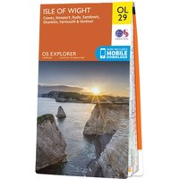
Ordnance Survey
Ordnance Survey OS Map of Isle Wight: Explorer OL29 - Weatherproof
£12.99
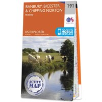
Ordnance Survey
Ordnance Survey OS Map of Banbury, Bicester & Chipping Norton: Explorer 191
£16.99

Ordnance Survey
Ordnance Survey OS Map of Ben Hope, Ben Loyal & Kyle of Tongue: Explorer 447
£16.99

Pathfinder
Ordnance Survey Pathfinder The Home Counties From London By Train - OS Guides 72
£12.99

Ordnance Survey
Ordnance Survey Wellingborough 1896-1904 - Historical Reproduction Map - 1 Inch To 1 Mile 1:63 360 Scale
£11.99

Ordnance Survey
Ordnance Survey OS Road map set - Britain Complete
£51.14

Ordnance Survey
Ordnance Survey Wells 1896-1904 - Historical Reproduction Map - 1 Inch To 1 Mile 1:63 360 Scale
£11.99

Ordnance Survey
Ordnance Survey Sollas 1896-1904 - Historical Reproduction Map - 1 Inch To 1 Mile 1:63 360 Scale
£11.99

Ordnance Survey
Ordnance Survey Ayr 1896-1904 - Historical Reproduction Map - 1 Inch To 1 Mile 1:63 360 Scale
£11.99

Ordnance Survey
Ordnance Survey Bristol 1896-1904 - Historical Reproduction Map
£11.99

Ordnance Survey
Ordnance Survey Aberayron 1896-1904 - Historical Reproduction Map - Inch To Mile 1:63 360 Scale
£11.99

Ordnance Survey
Ordnance Survey Ambleside 1896-1904 - Historical Reproduction Map - 1 Inch To 1 Mile 1:63 360 Scale
£11.99