
Welcome to Yorkshire
Published on November 18th, 2025
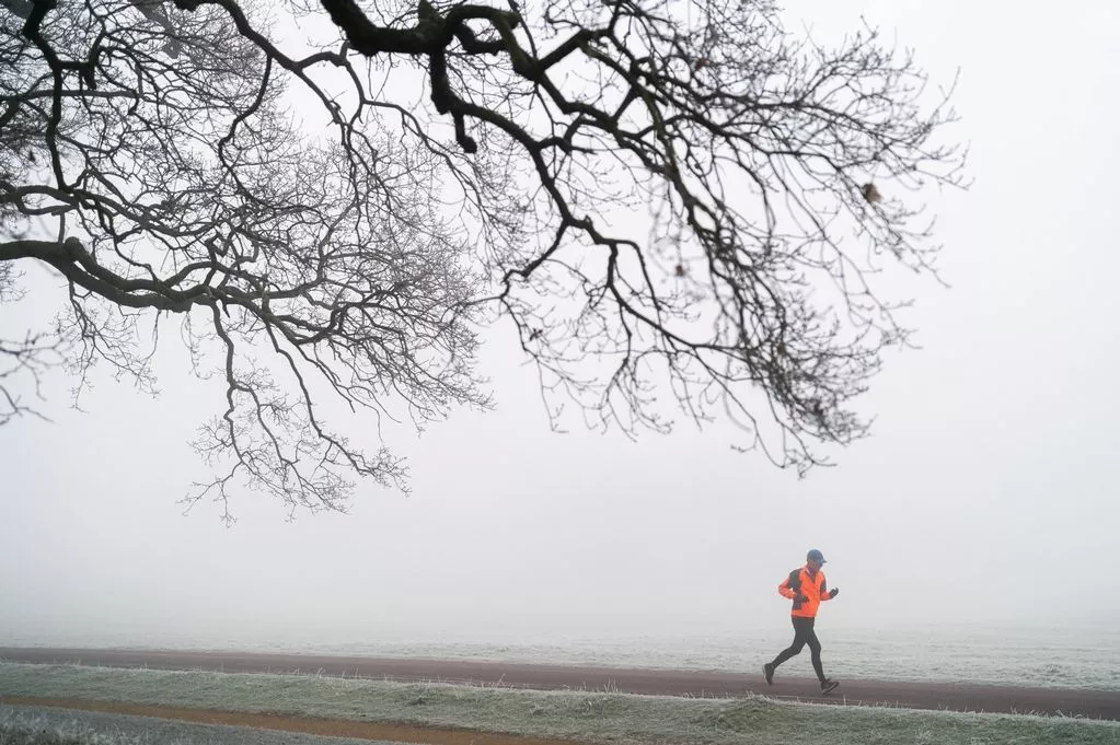
•Right then, it seems winter has decided to arrive with a proper bang. Anyone thinking of leaving the big coat in the wardrobe this week might want to reconsider. The UK Health Security Agency has put parts of England on high alert as a serious cold snap is heading our way, with the Met Office forecasting bone chilling temperatures that could drop as low as minus 10C.
For places like Yorkshire, the North West and the North East, an amber cold health alert is now in place, which is basically the official way of saying "this is serious, folks." It is time to find those thermal socks and get the kettle on.
What these weather warnings actually mean
It is easy to hear about weather alerts and think it just means a bit of bad weather is on the way. But these colour coded warnings from the health agency are very specific. A yellow alert, which covers the rest of England from 12pm on Monday, 17 November 2025 until 8am on Saturday, is a heads up to be prepared. The amber alert, however, is a step up.
This one suggests the cold weather could have "significant impacts across health and social care services." Picture this: hospitals getting busier, care homes struggling to keep the heat in, and a real danger for older people or anyone with existing health problems. The cold does not just make people feel miserable; it can cause serious health issues. Keeping indoor temperatures safe becomes incredibly important in places like clinics and hospitals. This kind of severe weather puts extra strain on emergency services, which are often already busy managing everything from recent flood warnings to illegal shop raids.
The Met Office forecast: get ready for snow and ice
So, what is causing all this drama? The Met Office has issued yellow weather warnings for snow and ice across parts of Scotland and northern England, running from Monday through Thursday. This is the first proper cold snap of the year, bringing with it seriously low, sub zero temperatures.
Chief forecaster Paul Gundersen warned:
"Scattered showers feed into the North East and far north of mainland Scotland on Monday night, bringing a risk of icy conditions on roads and pavements." And it does not stop there. "An area of rain will reach the west of Scotland early on Tuesday morning, with a risk of this turning to snow as it moves inland."
For anyone living on higher ground, the chance of seeing significant snowfall is real. Gundersen said: "A period of snow is likely over high ground, with accumulations of 2 to 5cm possible above about 150 metres in elevation, and as much as 5 to 10cm above 400 metres." This amount of snow could cause disruption to travel. Some reports are even talking about a massive 500 mile long snow band hitting areas including Yorkshire.
The coldest days are yet to come
If you think that sounds chilly, just wait for the middle of the week. Deputy chief forecaster Tom Crabtree pointed to Wednesday to Friday as the peak of this cold snap. He said: "Wednesday to Friday will be the coldest part of the week, and this period has the greatest potential for impactful weather, with multiple warnings in place."
Just how cold could it get? Brace yourself. "Overnight, temperatures could get down to minus 10C, with a significant wind chill from the strong northerly wind making things feel even colder," Crabtree stated. That wind chill factor is no joke; it is what makes the cold feel like it is biting right through your clothes. Wintry snow showers are expected to move south, mainly hitting coastal areas.
Here is a breakdown of potential snowfall:
- Low lying areas (north and east): 2 to 5cm where showers are frequent
- Hills (Northern Ireland, northeast England, Scotland): 5 to 10cm
- Above 300 metres (northeast England, Scotland): 15 to 20cm possible
Despite the chill, there will be some sunshine, but daytime temperatures will be much lower than average. As Crabtree noted, "With sub zero temperatures in the first cold snap of the year, updates to the current warnings are possible, so it is important people keep up to date with the forecast." Conditions should start to ease from Friday.
A serious warning for heart health
This dramatic drop in temperatures is not just an inconvenience; it carries very real health risks, especially for people with heart conditions. The British Heart Foundation is urging anyone with cardiac issues to take extra care during this freezing weather.
Ruth Goss, senior cardiac nurse at the British Heart Foundation, explained: "Cold temperatures can increase the risk of heart attacks and strokes, and people with cardiovascular disease are also more at risk of serious illness if they get seasonal respiratory infections like flu." For people who suffer from angina, cold air can trigger chest pain. Goss added: "It is especially important that people living with heart conditions are well prepared for the cold snap this winter by wrapping up warm and having their free flu jab."
The BHF has simple but effective tips for staying safe and warm:
- Keep your home heated to at least 18C
- Layer up with jumpers, socks and blankets
- Stay active indoors by moving every hour
- Eat warm meals and drink hot drinks
- If you have angina, wear a scarf loosely over your mouth and nose when outside to warm the air before breathing
This cold weather event is a reminder for everyone in the UK, from Yorkshire to Scotland, to look after themselves and check in on neighbours or family who may be more vulnerable to the effects of the bitter cold.
Stay warm and stay safe.
Yorkshire Team
The Yorkshire.com editorial team is made up of local writers, content creators, and tourism specialists who are passionate about showcasing the very best of God’s Own Country. With deep roots in Yorkshire’s communities, culture, food scene, landscapes, and visitor economy, the team works closely with local businesses, venues, and organisations to bring readers the latest news, events, travel inspiration, and insider guides from across the region. From hidden gems to headline festivals, Yorkshire.com is dedicated to celebrating everything that makes Yorkshire such a special place to live, work, and visit.
View all articles →