Welcome to Yorkshire
News • May 1st, 2024
|Discover the surroundings of Hawes in the Yorkshire Dales with a 10 mile walk that showcases the best of the local landscape and cultural heritage. Starting from the bustling market town centre, this route takes you through charming streets lined with traditional stone houses before leading into the dramatic countryside.

The Route
- what3words for start point: ///instilled.flipper.promoting
- Start Point: Main St, Hawes DL8 3QL
- Finish Point: Main St, Hawes DL8 3QL
- Distance: 10 Miles
GPX Route Map
Walk Description
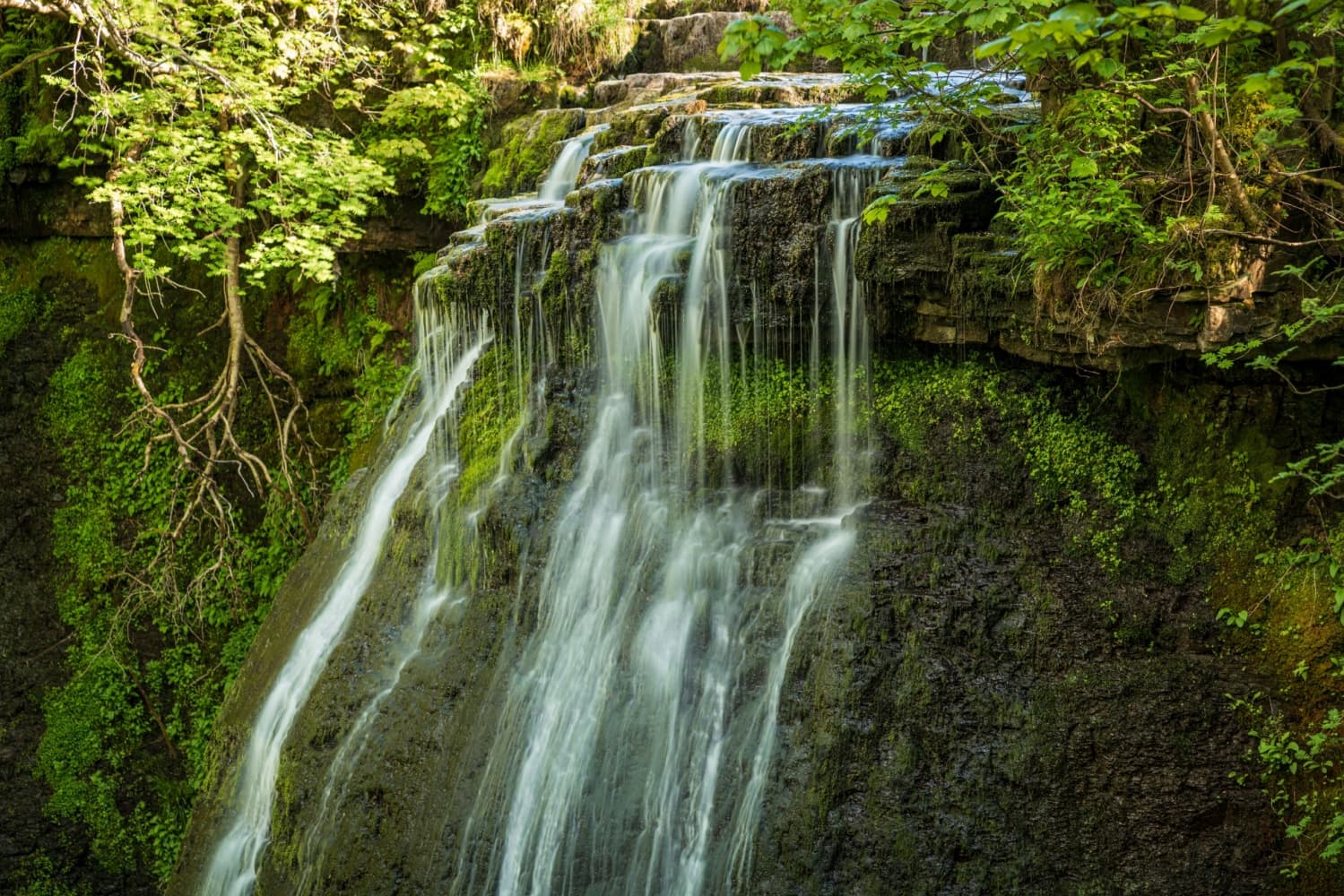
The walk follows a path along the River Ure, and takes in 3 waterfalls: Hardraw Force, Cotter Force and Aysgill Force.
The journey commences in the heart of the Hawes and proceeds northwards, traversing the River Ure. The path then ascends alongside Hardraw Beck leading up to Hardraw Force Waterfall. Visitors can access this natural spectacle through the historic Green Dragon Inn.
The trail continues its ascent westward to Bluebell Hill, reaching an elevation of over 1000 feet. This vantage point offers expansive views of the area. The route then descends to rejoin the River Ure and follows it westward to Cotterdale Beck, leading to the picturesque Cotter Force Waterfall, characterized by its series of six cascading steps, each forming a distinct waterfall.
Following the visit to Cotter Force, the path returns along the river towards Appersett, where it picks up Widdale Beck heading towards Appersett Viaduct. The journey loops back towards Hawes, offering an optional detour south along Gayle Beck to explore Aysgill Force Waterfall.
This circular route is 10 miles long and at its highest on Bluebell Hill reaches 1000ft above seal level, so is somewhat challenging.
Yorkshire Team
The Yorkshire.com editorial team is made up of local writers, content creators, and tourism specialists who are passionate about showcasing the very best of God’s Own Country. With deep roots in Yorkshire’s communities, culture, food scene, landscapes, and visitor economy, the team works closely with local businesses, venues, and organisations to bring readers the latest news, events, travel inspiration, and insider guides from across the region. From hidden gems to headline festivals, Yorkshire.com is dedicated to celebrating everything that makes Yorkshire such a special place to live, work, and visit.
View all articles →

Comments
0 Contributions
No comments yet. Be the first to start the conversation!