
Welcome to Yorkshire
Inspiration • December 9th, 2020
|
Walk Route
- what3words for start point: ///giants.splint.pipeline
- Distance: 7 miles
- Start Location Name: Buckden Car Park
- Finish Location Name: Buckden Car Park
OS Route Map & GPX Download
The Ordnance Survey map below shows the full walk route, in pink. You can use this (try the full screen mode) on your smartphone to guide you where to go.
Download the GPX file for your GPS navigation device using the pink link above, and you’ll be able to use this walk on your own devices.
Walk Description
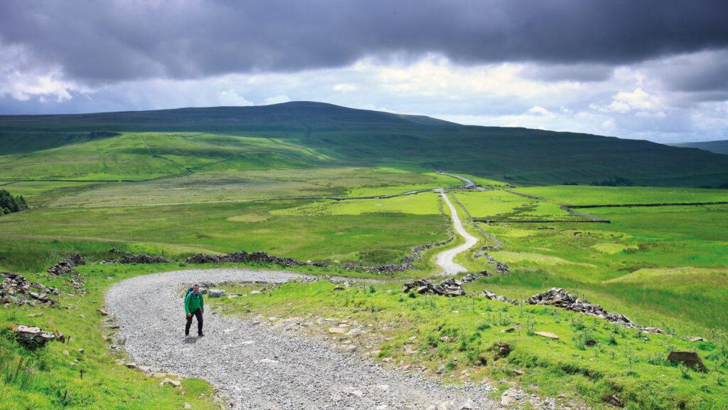
Seeking an exhilarating challenge? Embark on a captivating seven-mile loop that begins at the Buckden car park and ascends to the lofty peak of Buckden Pike, before descending through an array of awe-inspiring landscapes. This trail is a journey through time, weaving through the Yorkshire Dales' historic mining remains, coursing through the pastoral beauty of Upper Wharfedale, and concluding along the tranquil banks of the River Wharfe.
The diversity of your surroundings will captivate your senses. From lush hay meadows and leisurely riverside ambles alongside the River Wharfe, to the rustic charm of upland hill farms and the untamed expanse of wild moorland—every step reveals a new facet of this stunning region.
As you crest Buckden Pike, prepare for a breathtaking panorama under expansive skies. The view stretches far beyond the horizon, offering an unmatched vantage point that rewards your efforts with a visual feast.
But there’s more than just natural beauty to discover. At the summit, you'll find a poignant Trig Point, which doubles as an RAF memorial commemorating a Polish airman who crashed on these very moors during a snowstorm in 1942. In a miraculous tale of survival, the crash's sole survivor managed to navigate through the blinding snow by following a fox, ultimately escaping the treacherous moorland. This walk offers not just a physical journey, but an emotional and historical one as well.
Yorkshire Team
The Yorkshire.com editorial team is made up of local writers, content creators, and tourism specialists who are passionate about showcasing the very best of God’s Own Country. With deep roots in Yorkshire’s communities, culture, food scene, landscapes, and visitor economy, the team works closely with local businesses, venues, and organisations to bring readers the latest news, events, travel inspiration, and insider guides from across the region. From hidden gems to headline festivals, Yorkshire.com is dedicated to celebrating everything that makes Yorkshire such a special place to live, work, and visit.
View all articles →


