
Discover Carnaby
Carnaby is a village located in the East Riding of Yorkshire, governed by East Riding of Yorkshire Council. It has a population of 415 residents and falls under the YO16 postcode area. Known for its rural landscape, Carnaby offers a quiet community setting with historical roots in agriculture and local industry.
Explore the map below to discover accommodation, attractions, restaurants, and live events across Carnaby. Scroll down to browse featured listings and plan your perfect visit.
Stay in Carnaby

Bungalows 1-7 Carnaby Covert Lane
Bungalows 1-7 Carnaby Covert Lane provides comfortable accommodation in carnaby.

Little Eden Holiday Lodge Park
Little Eden Holiday Lodge Park provides comfortable accommodation in carnaby.

Carnaby Caravans ltd
Carnaby Caravans ltd provides comfortable accommodation in carnaby.

Little Eden Country Park, Bridlington
Little Eden Country Park, Bridlington provides comfortable accommodation in carnaby.

Bridlington Holiday Park
Bridlington Holiday Park provides comfortable accommodation in carnaby.

Manor Court Hotel & Restaurant
Things to Do in Carnaby

John Bull's Candy Kingdom

Our Caravan
Located in the scenic area of Carnaby, Our Caravan offers convenient parking for visitors exploring Park Rose Village and the surrounding attractions in Bridlington. While specific payment details are not available, it is likely a standard pay-and-display facility, making it a practical choice for tourists seeking easy access to local sights.

Park Rose Village
Park Rose Village in Carnaby offers convenient parking for visitors staying in their unique accommodations, such as yurts and pods. Located near Bridlington, this facility provides ample parking spaces with electric hookups, making it ideal for campervan travelers. Enjoy a comfortable stay with easy access to the scenic surroundings of Yorkshire.
Food & Drink

The Café at Park Rose
The Café at Park Rose in Carnaby provides a convenient parking option for visitors exploring the charming Bridlington area. While enjoying a delightful meal at the café, tourists can take advantage of the nearby pay-and-display parking facilities, ensuring easy access to local attractions.

Azzurro Ristorante Italiano

Manor Court Hotel
Manor Court Hotel offers italian dining in carnaby.

Interactive Map
View accommodation, attractions, restaurants, and events on the map
Geographic Facts
This village is geographically within the following regions:
- Population
- 415
- Postcode
- YO16
- Administrative area
- East Riding of Yorkshire
- Dialing code
- 01262
Data sourced from Wikidata and verified public records
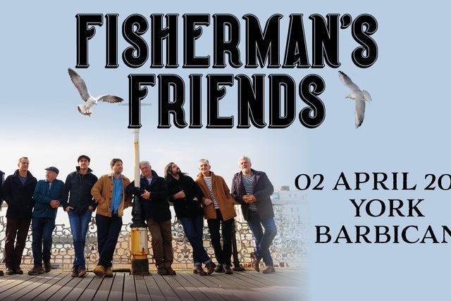
Upcoming Events in Carnaby
View All Events in Carnaby →

Latest news from Carnaby
All Local News →
Goole & Howdenshire Business Excellence Awards – Winners: The Complete List of 2026 Honorees
The Goole & Howdenshire Business Excellence Awards 2026 was a huge celebration. See the full list of winners from the record-breaking ceremony in Yorkshire.
Walkshire in Carnaby
More Walks in Carnaby →
Walk: Burton Agnes Circular
This circular walk from Burton Agnes in East Yorkshire through Kilham and Harpham is perfect for well-behaved dogs, offering off-lead opportunities through fields and quiet paths. There's a great spot for a paddle halfway through. The terrain is mostly flat with scenic views of the Yorkshire Wolds. Expect muddy field paths and tracks after rain, and varying conditions in arable fields. Waymarking is intermittent, so downloading offline maps is recommended for guidance. You'll encounter several gates and five stiles, with some requiring help for dogs. Be cautious of electric fences. Plan for 3-5 hours to complete the walk. The Route what3words for start point: ///beams.outwards.reception Start Point: Burton Agnes Finish Point: Burton Agnes Distance: 6.7 Miles GPX Route Map burton-agnes-circularDownload Walk Description Path Alongside Sportsfield From the village pond in Burton Agnes, head towards the main road, turn left along the grass verge to the Blue Bell Hotel. Cross the road and follow the Yorkshire Wolds Cycle route No.1, passing Burton Agnes C of E Primary School and Nursery. After the sports club, turn left through a hedge gap to a footpath along the crop field's edge with a fenced football field on your left. Sandy Lane Continue on the wide, grassy path through a gap in the hedge. Pass a yellow waymarker and head diagonally uphill. Cross into the next field through a hedge gap, following the obvious path with views of the Yorkshire Wolds. Pass through a metal gate onto Sandy Lane. Sewage Works Cross Sandy Lane and continue through a hedge gap onto an undulating path. Climb a stile and head towards a gate. Follow the path diagonally across fields, passing through waymarked gates. Reach a tarmac road, turn right downhill, then follow a wooden footpath sign left along a field edge. Continue past the sewage works. Bracey Bridge Follow the wide green track with a beck to the right. Turn sharp left up a bank to a marked field path. Continue through fields via way markers, heading towards tall trees. Cross the road and descend steps to Bracey Bridge picnic area. Harpham Village Pass the picnic tables and cross the lay-by road through a kissing gate onto a tarmac track. Follow footpath signs through kissing gates and fields, crossing Low Thorpe Beck. Continue past farm buildings to a quiet road leading to Harpham village. Finish From St Quintin Arms, turn left at the crossroads towards Bridlington. Turn right onto a path, following waymarkers over stiles and fields towards Burton Agnes. Cross a bridge and stiles, then follow the path towards the village. Turn right onto the road and return to the village pond. Afterwards Why not take a look round Burton Agnes Hall or stay the night at the Blue Bell.